| |
| |
FR360 Prospect Mtn s(u)
The eastern San Juan
Mountains have a much different character,
than their namesake to the west. In the east
they are an alpine plateau with large lumps on
top, much like a fist with protruding
knuckles. Two roads and one named pass reach
summits in close proximity in the central
area:
FR330 Greyback Mtn s(u) (which also goes
through Summitville), Elwood Pass, and
this one. Even if this road is the lowest of
the three by a small margin, it runs right
along, what looks like the knuckles of the
plateau, and arguably shows them off the best.
FR667 up the east fork of Silver
Creek. This road leaves US60 between Wolf Creek Pass
and Pagosa Springs. Like all the other
approaches from the north this involves a lot of
climbing on gravel roads in the woods on
possible washboard roads. Approaching the top, FR360 stays
right, where all the heavy machinery heads left
to Summitville. (But I did not encounter any of
this traffic). There is no steep well defined
summit on FR360, but instead a mile or two of
curvy road with a couple of rounded 13ers
rolling in the landscape to the south, and flat
topped mesas to the north. Scenically placed old
wood cabins show the appreciation for this
location, that others have had in the past.
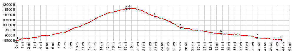
From East. (described
downwards) The views quickly disappear. There is
a rough, sandy section along the top that is
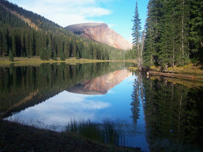
much easier negotiated in a downward direction. One more scenic spot, that stays
in memory is the curiously named "Lake de
Nolda". Every time I have reached this spot, the
water has been so calm that it gave an
absolutely perfect reflection of the wedge
shaped Lookout Mountain (12448ft, picture
above). The last time the sun even appeared.
Otherwise the lake distinguishes itself through
a large number of "private - no trespassing - no
fishing" signs. This may seem like the end of the
descend, but distance wise there still is a long
ways to go. The profile joins lower approaches
of Blowout Pass
and Stunner Pass
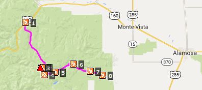
and ends at the edge of the San Luis Valley,
west of La Jara. A Dayride with this point
as intermediate summit is on page: FR330
Greyback Mtn s(u) 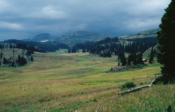 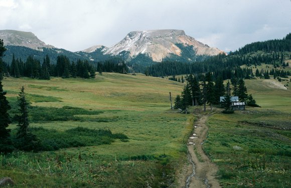
- |
|||||||||||||||||||||||||||||||||||||||
|
|
advertisement |
|
|
advertisement |