| |
| |
FR359 summit(u): Eastern San
Juan Mtns
Seen from US160 between South
Fork and Del Norte, the Eastern San Juan Mtns
don't show themselves from their most interesting
side. That's okay, the majority of people just
want to drive the road anyway. The mountains on
the south side of the highway give the appearance
of a large lumpy loaf of bread. Traveling over
this summit shows off a more interesting side.
There are peaks on top of them hills. Granted,
they are rounded too. But the panorama of the
isolated La Garita Peaks also awaits. Most of this
area is open to motorized travel, no wilderness
here, not since the various gold silver and medal
rushes and busts. But the mountains survived, and
now -paradoxically- there are so many roads that
traffic is actually very light. This makes a great
mountain biking loop.
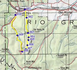
From East. The turnoff from US160
up Del Norte Peak Road is signed. The wide dirt
road goes through a burn area, with a single
rounded mountain visible above slopes of trees.
This route will stay well to the right of rounded
Del Norte Peak. At the next fork, the route turns
onto signed FR350 uphill. The road soon looses its
gravel and enters a firewood cutting area. Staying
in the forest and narrowing still further, the
road stays steep, not too rocky and rideable. The
first time any mountains can be glimpsed through
the trees is on top of the FR350 summit (this is
only an intermediate summit on this ride). An out
and back trail leaves from the forested top.
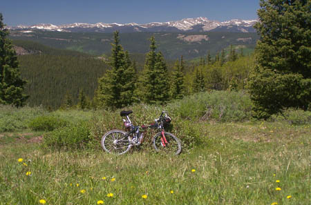
From West. (described downwards) For the
FR359 mountain biker the best part of the ride
starts. A short steep descend leads to a series of
alpine meadows, FR359 traverses them, like a
ribbon that has been thrown out over a carpet of
wild flowers (if you ride in June). There are
fewer rocks on this section of the trail. After
that high point, FR359 merges onto well traveled
FR332 from Crystal Lakes, then graveled FR360,
which is a long roll back down to South Fork. Once
Beaver Creek Reservoir is reached, camping is only
possible in developed pay sites. The last few
miles before South Fork are paved.
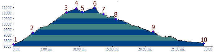
Dayride. 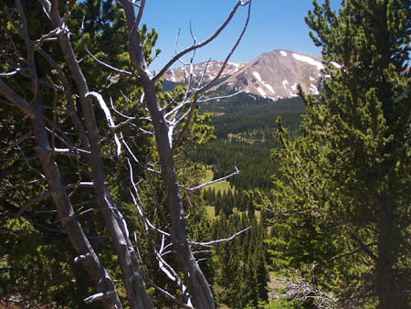
|
 Approaches
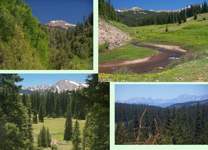
|
|
advertisement |
|
|
advertisement |