| |
|
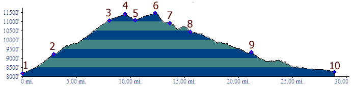
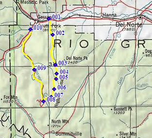
01.(8150ft,mile00) START-END EAST: jct Del Norte
Peak Road (FR345) - US160, east of Del Norte.
02.(9220ft,mile03) route stays right onto FR350
03.(11053ft,mile09) This profile stays right.
04.(11410ft,mile10) FR350 shoulder summit
05.(11090ft,mile11) road on right goes down
Cross Creek. This is the direct approach to
FR350 summit(u) from west.
06.(11480ft,mile13) TOP: FR359 summit(u).
07.(10910ft,mile14) jct with FR332. Left goes to
Crystal Lakes. This profile stays right.
08.(10450ft,mile16) Profile turns right down
FR360 along Beaver Creek.
09.(9330ft,mile32) Road along Cross Creek joins
from right. Connects to point 5.
10.(8260ft,mile29) START-END WEST: jct US160 -
Beaver Creek Rd, just west of South Fork.