| |
| |
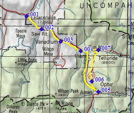
Co145 Alta Lakes turnoff(sh)
If you have come down the north
side of Lizard Head Pass towards Telluride, you
probably remember a very noticeable uphill, on
what is supposed to be a long descend. That
happens to be also the place where a dirt road
turns up towards Alta and its lakes. With the help
of a different, smooth dirt road this spot is the
summit point on a short scenic loop.
From West 1. Co145 between between
its junction with the Dallas Divide Road (Co62)
and Telluride can be a stressful ride, due to
heavy traffic and the absence of a shoulder, in
spite of the peaceful canyon surroundings. If you
don't mind riding on an extremely smooth dirt
road, peace returns to the valley, when you take
the turnoff onto FR623. The road is known by
different names, Vance, South Fork and Illium all
apply to this stretch. The road passes a police
department or something of that nature, then a
mining operation, but after that it's really just
the South Fork of the San Miguel River with
Sunshine Mountain and Wilson Peak showing the way.
The road crosses in and out of national forest
land several times. There is no camping allowed
along this road. Finally it turns east and climbs
very steeply to join Co145. One could keep
following South Fork and ride up towards Ophir Pass. But to get
to this summit point the route turns left and
keeps climbing a little more, while on the descend
from Lizard Head
Pass. At the highest point a signed dirt
road turnoff shows the way to Alta Lakes s(u).
That summit can be cycled in an out and back ride,
or a loop incorporating trails from the Telluride
ski area. From West 2. (described downwards). It's
a fast paved descend. Even from this low, there is
one especially memorable view of the wall of peaks
behind Telluride, with a swoop of road in the
foreground. The profile ends where it joins the
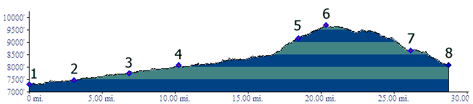
other approach. Dayride PARTIALLY PAVED / UNPAVED Co145 Alta Lakes turnoff(sh) , additional out
and backs : 5 miles up Fall Creek Rd >
down Fall Creek Rd > east on Co145 > south
on FR623 South Fork > Vance Junction > north
on Co145 <> out and back to Alta Lakes
>> down Co145 <> out and back to
Telluride >> west on Co145 > back to
starting point: 60.9miles with 5080ft of climbing
in 5:37hours (VDO MC1.0 m3:11.9.20).
|
 Approaches
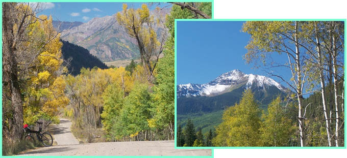
|
|
advertisement |
|
|
advertisement |