| |
| |
Moffat County in north
western Colorado is really a gravel biker's
paradise, provided you don't picture
paradise with bike stores, bars and
gathering places. This is pure semi-dessert
with a dense network of "gravel" roads, many
much smoother than that label would lead to
suspect. My favorite area in this county
sofar, is the mesas around Little Snake
River. This road is well west of there.
The profile makes a left turn
onto CR46. The major landform in the
distance is a big subdued wedge by the name
of Vermillion Bluffs. It makes the
background in the view to some apparently
very relaxed wild horses in this area, often
alone in the scenery, as apposed to groups
of 4 or 5, as in yesterday's ride. The last part of this small
climb, before the jct with CR45 actually
feels like a real climb. CR46 itself crests
on a well defined low ridge with a group of
burned trees crowning the top.
From
South. (described downwards) Ahead of
here is a ruler straight section of road
with a big dip. the "Big Dip" is actually a
geologically structural basin, named
Sheephead Basin. It looks like the next high
point after this high meadow might actually
be a little higher. But the map confirms
that the initial crest of the ridge is the
true summit. This dip is the most sandy part
of the trip. Especially the low parts of
this basin have faceplant written all over
them. The road descends quickly through more
burned trees to paved Co318. The profile
continues on Co318 down the gentle valley
back to the starting point of the other
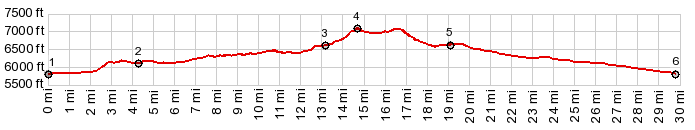
approach. 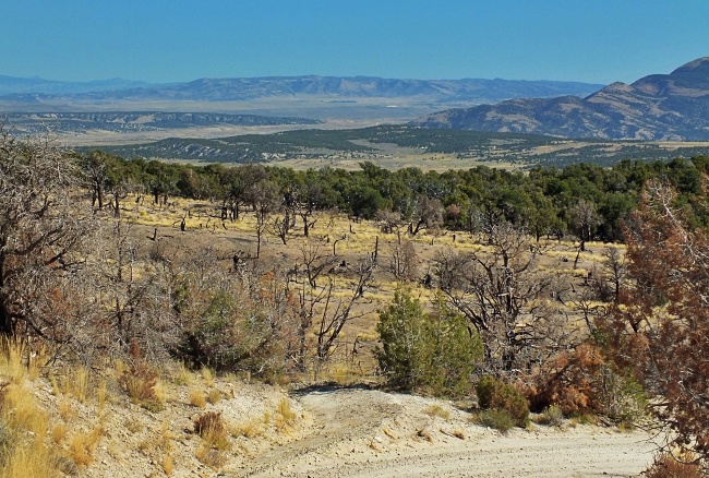 Dayride with this point as highest summit PARTIALLY PAVED / UNPAVED: ( < CR71 Godiva Rim | Yellowjacket Pass (Meeker) > ) CR45 Dry Mtn Rd s(u) : CR71 a short distance from its jct with CR21 > down CR71 > Co318 west > CR67 north > CR48 west > jct CR48 - CR45 <> out and back on CR45 north > CR46 west > turnaround point before jct with CR52 >> CR45 Dry Mtn Rd south > CR45 Dry Mtn Rd s(u) > Co318 east > back to startingpoint on CR71: 52.9miles with 2890ft of climbing in 4:50hrs (garmin etrex30 m3:20.9.30). Notes: still and again toooo hot 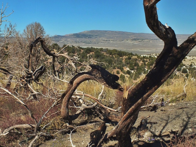 |
|
|
advertisement |
|
|
advertisement |