| |
| |
CR260 Brush Hollow Rd - CR271
(sh)
This is one of several summit
points north of Hardscrabble
Pass, that connect the Westcliff area with
the Canyon City area, traversing through the Wet
Mountains and the De Weese Plateau.
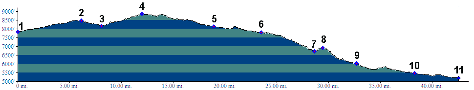
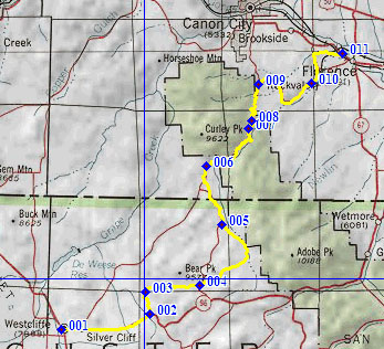
From West. Climbing towards Hardscrabble
Pass from Westcliff, CR260 turns off on the left
and descends a little again, traversing north
along vacation housing, all of which has pretty
nice views of the Sangre de Cristo Range. A few
short sections of this road have extreme wasboard
surface. Brush Hollow then turns west and reaches
a high point at the intersection with CR271.
Looking to the right you can already see the
intersection with the Hardscrabble Pass
Road From East. However the profile descends
from here. Choosing the downhill route whenever
possible at the following intersections, the route
leads through a sparsely populated ranch valley
following CR271 along Bear Gulch and then joining
CR143 along Oak Creek. You could also follow CR143
all the way between the Wet Mountain Valley and
Canyon City over a different summit point. Both
routes descend along Oak Creek and then mount a
small 100 ft climb, to what may be the scenically
most interesting point along the route. From here
the Stultz ATV trail also descends through a
canyon towards the east. The road followed by the
profile winds down in a few serpentines to arrive
at a fork, presenting options for Canyon City or
Florence. The profile continues into Canyon City.
But choosing the descend through the funky town of
Rockvale to Florence also its own peculiar charm. A Dayride with this point as intermediate
summit is on the Hardscrabble Pass
page.
|
 Approaches
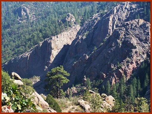
|
|
advertisement |
|
|
advertisement |