| |
|
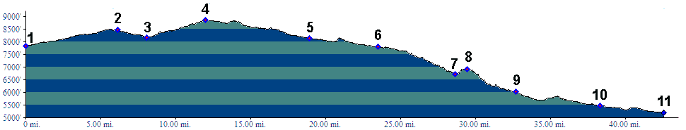
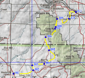
01.(7840ft,mile00) START-END WEST: Westcliff
02.(8470ft,mile07) profile turns left onto CR260 Brush
Hollow Rd
03.(8160ft,mile09) intermediate low point
04.(8860ft,mile13) TOP: jct with CR271; profile stays
left at following intersection
05.(8149ft,mile20) profile stays right at this and next
intersection
06.(7800ft,mile24) jct with dead end roat to Bear Gulch
Rd, and beginning of Oak Creek Canyon
07.(6700ft,mile29) intermediate low point, "winter tires
required for next climb"
08.(6920ft,mile30) intermediate high point
09.(6030ft,mile33) profile stays right at this and next
intersection
10.(5470ft,mile39) Rockvale
11.(5200ft,mile43) START-END EAST: Florence