| |
| |
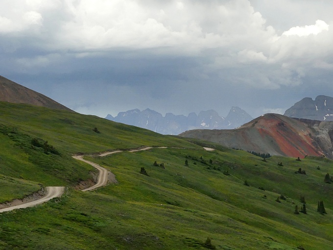
The San Juan Mountains are
dissected by old mining roads. Many famous
examples go over named passes. Here is a
road above 12 thousand feet, in the middle
of some of the highest San Juan passes, that
just carries county road/ forest road
numbers. Like the surrounding passes, this
one is well surfaced (not paved), but in
places extremely steep. In the summer the
road is crowded with organized and
disorganized jeep tours, sporting license
plates from Colorado and all states south.
Unlike the surrounding passes, this can be a
very short trip.
Approaches There is noting like starting
off the day with a good walk. The surface of
this county/forest road is excellent. But it
is so steep, for me there is no significant
time difference to be gained by riding (even
if i could) - so I just walk a large
portion. A mine above serves as a good yard
stick for progress but the true improvement
in the scenic situation is because of a
better vantage point on Lookout Peak, South
Lookout Peak, and US Grant Mountain, in the
Ophir Pass
area. That mine finally serves as good
foreground material for photos. Just a few
more rolling switchbacks and the road is
solidly above treeline, with views of high
and steep mining road passes in 3 out of 4
directions. The highest point is reached
before a kind of rolling traverse above
treeline finally takes the rider north - at
last for a longer time in the saddle. I
borrowed the name "Ohio Peak" from the
highest point above, to the east.
From
North. (described downwards) Before
the road finally descends there is one last
possibility for scenic walks in both
directions on the tundra. McMillan Peak to
the south would be the higher of the two
destinations, still below 13 thousand feet.
Even just staying on the road, the view from
here is the most panoramic along the route.
Red Mountain No3 stands out as a kind of
tetrahedron with roads carved all over it,
as if somebody had put it through a bread
slicer. When I first saw it, I did not know
yet, that my return path would lead me along
one of those slices. It is possible to descend
quickly back down to US550, arriving still
south of Red
Mountain Pass. But the profile for
this summit, turns right at the next unpaved
road. There is gate here, along with a sign
saying, Private Property - no motor vehicles
- hikers, skiers and cyclists welcome. What
a concept ! There should be a Nobel Prize in
this category. More on the Red Mountain
No3 Rd s(u) page
|
|
|
advertisement |
|
|
advertisement |