| |
| |
CR14 Deer Valley Rd via CR157 Unpaved and remote Deer
Valley Rd can be used to approach the
Dinosaur Canyon area from the east.
Together with CR157 (the obvious route for
Dinosaur bound travelers from the east) it
makes a small shoulder summit, climbing
over Blue Mountain, which rises above the
upper Yampa bench. This is the lowest of
the shoulder summits along CR157 on the
way to Dinosaur NM.
There are 2 short sandy
stretches. Otherwise the road surface was
perfect for my Klein Mantra, and I would
guess most gravel bikes feel at home here
too. The route reaches a high point
immediately before the signed turn off down
CR157
From
South. (described downwards) This is
a fast decent through grassy hills. Only
once does the road cross a small ravine, and
the result is rough rocks and deep ruts.
After a left onto CR16, this is now a
elaborately engineered gravel road with too
many small rocks, to make for a perfect
cycling surface. But it all works out in the
end, and the road joins pavement on US40 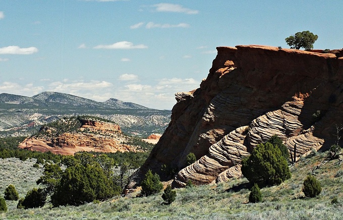
Dayride with this point
as highest summit
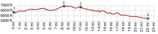
PARTIALLY PAVED / UNPAVED ( < CR14N Mantle Ranch Rd(sh) | Harper's Corner Rd s(u) > ) CR14 Deer Valley Rd via CR157(sh) : about 4+1/2 miles up Deer Valley Rd > up Deer Valley Rd > CR14 Deer Valley Rd via CR157(sh) > down CR157 > down CR16 > US40 east > back up CR14 Deer Valley Rd to starting point : 30.6miles with 2400ft of climbing in 3:04hrs (garmin etrex30 m3:20.5.10). Notes: short ride for a hot day. 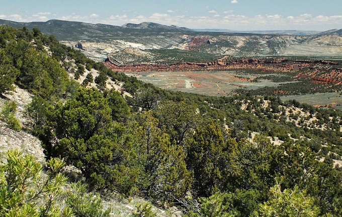 |
|
|
advertisement |
|
|
advertisement |