| |
|
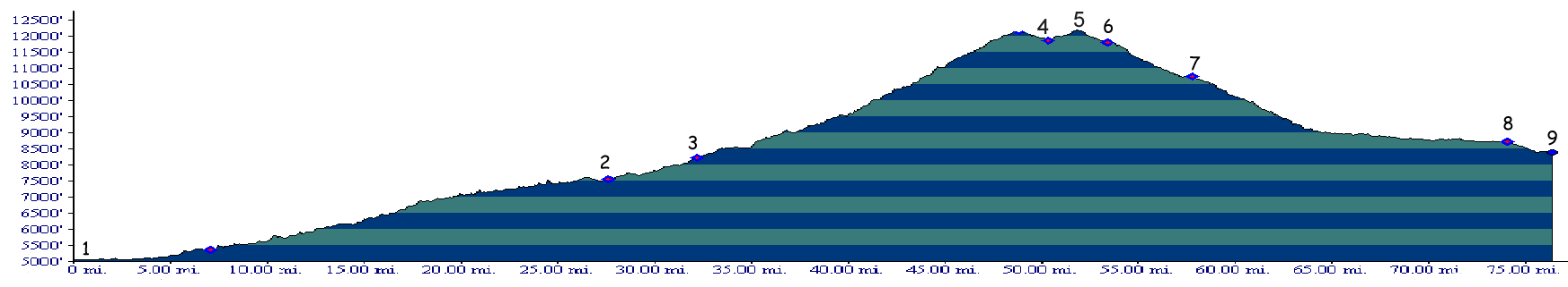
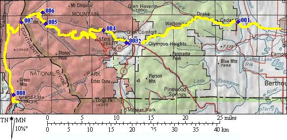
1.(5340ft,mile00) START-END EAST: western outskirts of Loveland on US 34
2.(7549ft,mile28) ALTERNATE START END EAST: downtown Estes Park. The route on the profile heads for the more northerly of the two park entrances, the Fall River entrance.
3.(8222ft,mile32) Fall River entrance to Rocky Mountain National Park
4.(11860ft,mile48) Iceberg Pass
5.(12180ft,mile52) TOP: highpoint
6.(11812ft,mile54) Visitor Center and turnoff to Fall River Pass is on right
7.(10747ft,mile58) Milner Pass
8.(8720ft,mile75) Grand Lake Park entrance
9.(9380ft,mile77) START-END WEST: downtown Grand Lake