| |
| |
Togwotee Pass This gentle, yet respectably
sized pass is a traffic funnel of sorts.
Extensive wilderness areas to the north and
south funnel Yellowstone bound traffic into a
straight ray crossing the continental divide,
using this pass. Not only does the (otherwise)
unpaved Great Divide Bicycle Touring squeeze
through this corridor. So does at least one
other publicized touring route published by
Adventure Cycling. But all is not lost. The
authorities have taken appropriate measures to
deal with the situation, demonstrating that
democratic forms of government can also take
effective actions. There is a wide shoulder
along the entire length of the road, that
makes riding out of traffic easy. There is
still a rogue remnant of a misplaced rumble
strip here and there, but all in all riding
this pass is an excellent, safe experience.
The land next to the road is fenced private ranch land for now, at least until some rich city guy gets a hold of it. Behind that is a buffer of National Forest land, and behind that is the land belonging to the animals and horse packers - relatively remote designated wilderness areas. The climb is gentle and never has to be anything but that. Curves in the road would be superfluous. Near the area of Lava Mountain and
Lava Ranch a barricade used in winter, signals
that we are now on a mountain road. The grade
picks up slightly. The road seems to head right
between the two most recognizable mountains in
this ridge of broken off mesas, Sublette
Peak(10537ft) to the east , and Two Ocean
Mountain (10724ft). 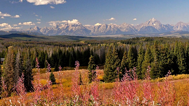
At the top sits a peaceful picnic
area on what looks like a left over meander of a
previous version of the highway. It is perched
at the scenic end of a small lake, that is not
visible from the road. A deep blue surface lies
surrounded by a wall and a spire of rock. So
this is what the headwaters of Wind River.look
like. 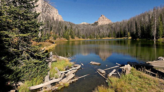
From South.
(described downwards) Rolling over the top I
wait for a vista of the Teton Range. It doesn't
happen. Turns out I have to wait a little while
longer. A spot very near to the top is signed
with the elevation sign 9658ft. As the bike
gains speed on the downhill , I pass another
sign :Continental Divide 9584ft. But there is no
sign that explains the paradox further. But then
when you think about, why should the highest
ridge form the actual water divide ? However if
the rain falls an inch west of the summit and
ends up in the ditch next to the road, it will
definitely end up in the Pacific. The relatively steep upper section
flanks the edges of bold mesas. It flows by
quickly, and the bike enters a wide high grassy
valley, resembling an elongated plate. Pedaling
is a logical occupation again, instead of just
letting it roll. After several miles of that
comes finally the overlook, that makes all those
distant Teton view fantasies come true - but
only in relatively early light, let's say till
12 noon, because of the light angle. The spot
for this viewpoint is an unassuming, almost
imperceptible small knoll next to the road. How
can this view be so different, than from the
road itself, only about 100 yards away. After this comes a long bowling
alley roll towards the valley. It seems a little
like a final raceway for all those family
tourists that have chauffeured their families
long distances across the continent. Here they
finally roll in a straight line on passing lanes
towards their destination, Yellowstone Park, The
road is wide. But there are still remnants of
rumble strips, which are very hard to see. So
you run over them quite a bit without warning. Once in the valley, the rarified
surroundings of multi-million dollar horse
ranches start lining the highway. The Teton
Mountain Range only becomes even more impressive
as it draws closer. The profile ends at at a
fork in the road. This is where you have to make
the decision weather to head for Yellowstone or
Jackson Village (or turn around if you are on an
out and back dayride, like me). There are no
services here, just a sign stating that there
are no public bathrooms in the nearby local
offices building.
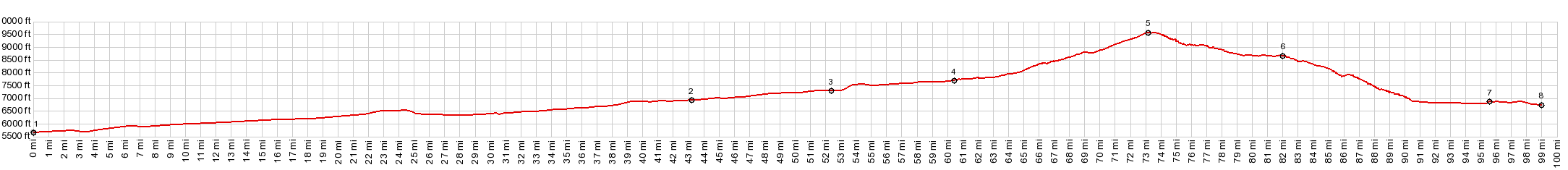
Dayride with this point as
highest summit
COMPLETELY PAVED ( < FR532 Warm Springs Rd s(u) | Teton Pass > ) Togwotee Pass x2 : near jct FR532 Warm Springs Creek Rd - US287 <> US287 west <> Togwotee Pass << turnaround point Moran Jct : 80.4miles with 5480ft of climbing in 6:59hrs (garmin etrex32x r4:23.09.15) |
|
|
advertisement |
|
|
advertisement |