| |
| |
FR532 Warm Springs Rd s(u) The GDMBR (Great Divide Mountain
Bike Route) uses this pleasant forest road to
climb the first 1200ft to Union Pass,
rather than the Union Pass Rd itself. I use it
as the other approach to the summit in the
profile below. I think both approaches have
their own different star qualities.
In the summer the view over to
Ramshead Peak can resemble balloons surrounding an
icicle. Sooner or later the thunderstorms happen,
and a few sharp Ramshead pinnacles can burst them
into action. The well used road crests in the
forest and descends about 200ft to the beginning
of the Warm Springs Rd. This intersection,
surrounded by a mountain lodge near the beginning
of the national forest land is well signed. It
even informs that the following this route on Warm
Springs Road will get you back to US287 after 18
miles. 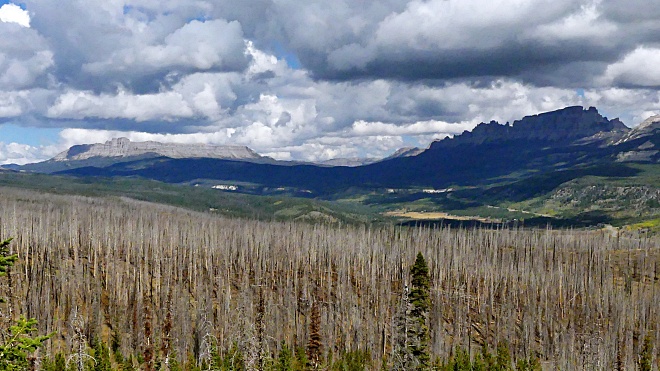
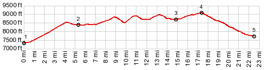
From the profile it is obvious that there are three more high points, until finally the true summit is reached with the fifth try. The ride is through pleasant deep forest on a bike friendly surface. The low point before the true summit is a beautiful sage park with craggy mountains in the distant north. Crossing the well defined top, the main features around the Togwotee Pass Rd take on starring roles, Pilot Knob and Pinnacle Buttes.
Dayride with this point as
highest summit
PARTIALLY PAVED / UNPAVED ( < Union Pass | Togwotee Pass > ) FR532 Warm Springs Rd s(u) , additional out and back : near jct Union Pass Rd - FR532 Warm Springs Rd > FR532 west > FR532 Warm Springs Rd s(u) > jct with US287 <> out and back on US287 west > short distance on FR515 Brook's Lake Rd north << turnaround point after ~1mile on FR515 >> US287 east > up Union Pass Rd back to starting point near jct with FR532: 43.7miles with 3940ft of climbing in 4:42hrs (garmin etrex32x m5:23.09.14) 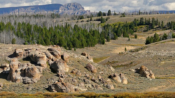 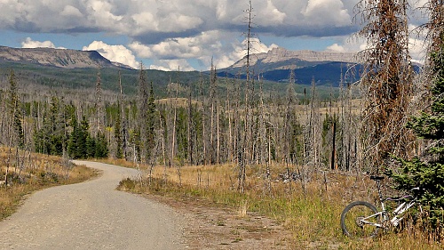 |
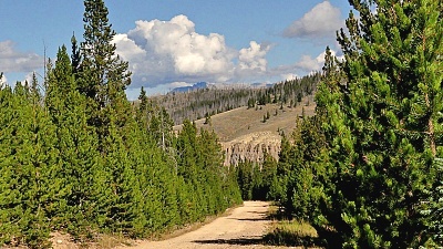 From West. (described
downwards). What is first obscured by trees a
little later appears framed between them. These
mountains do not rise extremely high above the
fruited lava plain. But the fact that each
mountain has its own characteristic and unique
shape, so different from its neighbors, gives this
landscape a fascinating appeal. A fast descent on
a good road quickly leads to the jct with US287
From West. (described
downwards). What is first obscured by trees a
little later appears framed between them. These
mountains do not rise extremely high above the
fruited lava plain. But the fact that each
mountain has its own characteristic and unique
shape, so different from its neighbors, gives this
landscape a fascinating appeal. A fast descent on
a good road quickly leads to the jct with US287|
|
advertisement |
|
|
advertisement |