| |
| |
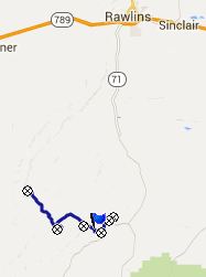
BLM3328 Miller Creek Road
southern summit(sh)
South of Rawlins the Continental
Divide is up for all sorts of tricks, like
splitting in two towards the north, and then
enclosing the Great Divide Basin within it. This
shoulder summit is a dozen miles or so south of
this point. Here the continental divide already
seems like an entity, that is unable to make up
its mind on where it wants to go. It follows a
confusing line over a sage covered maze of high,
bare hills. Technically this is the extreme
southern end of the Sierra Madre area. I think
that this road has some of the best views of the
entire area - if you like dessert scenery. It is
easily rideable and without any washboard surface.
The section described here is not graveled at all,
but a natural hard pressed smooth dirt - just a
few slightly very short, and just ever so slightly
sandy stretches. Another positive thing is that
this summit combines easily with Bridger Pass
in a loop ride.
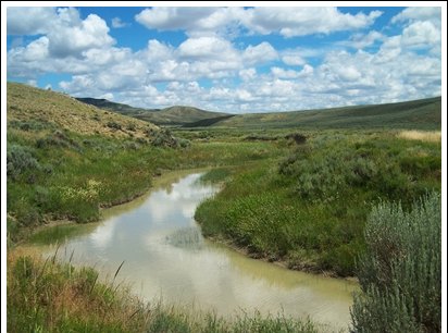
Here a peaceful puddle called Mud Creek provides
cool relief from the possible heat. The road
follows Mud Creek up valley, climbing in little
bits and pieces in a landscape, that - for now -
may seem a bit more dreary than the shapes of
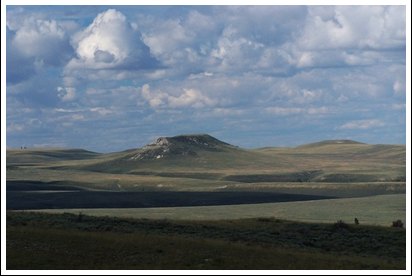
Separation Peak along Bridger Pass. This relaxing "rolling along" riding ends at the
junction with Cow Butte Road. A short steep
section is steep enough to make me get off my
bike. The road doubles back to the north and the
increased height now provides a dramatic vantage
point on the sun and shade patterns over
Separation Peak, and another nearby butte,
trapezoidal as a coffin seen head on. This
trapezoidal butte is Miller (Creek) Butte and
serves as a prime landmark for serveral rides in
this area.
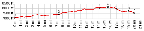
After more fine views the road joins BLM3328
Miller Creek Road. Both sides lead to summit
points. This one stays right (to the south) and is
slightly lower than the other one. Since the dip
between them is less than 300ft, I am calling this
a shoulder summit. The Continental Divide Trail
follows the road from the junction southwards, as
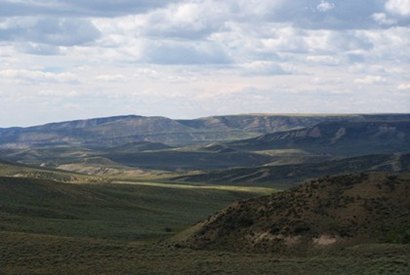
well as the Continental Divide itself. At the top the viewshed to the Sierra Madre Range
opens up: a dark lenticular shape of a tree
covered ridge, and way in the distance to the
north: the first mountains of Colorado From South. (described
downwards) A short, fairly steep descent leads
around the head of Sage Creek Basin. This stretch
has the most far reaching vistas. Shade from
clouds make a muddled patchwork pattern on the
sage hills. It stretches from here all the way to
the Laramie Mountains in the east. This far
vista lasts downhill to the junction with Mc
Carty Canyon Road. If heading back north from here (as the profile
does) the road descends a bit further to the Sage
Creek Reservoir turnoff, before climbing back up
to the Continental Divide on Wy71 If instead turning south, the descend lasts to an
isolated farmhouse in an interesting location, the
Mc Carty Ranch.
Dayride with this point as highest summit: COMPLETELY UNPAVED OR HARD MEDALLED: ( < Battle
Lake Pass | BLM3422
Hydrology Road s(u) > ) |
|
|
advertisement |
|
|
advertisement |