| |
| |
Ut39 Monte Cristo s(u)
Ut39 over Monte Monte Cristo Peak
is one of the bigger paved climbs in Utah. In
spite of this the route does not have summit
designations or road warning signs, that are
customary in Utah for roads like this. The climb
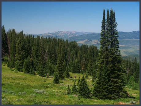
is not really steep and does not go through alpine
country, but instead pleasant forested hills, that
nontheless are every bit as big as the nearby
peaks in the Wasatch Range. Views are better
without the summer haze. On the west side,
starting a few miles east of Huntsville traffic is
light, so that the lack of a good shoulder is not
a problem.
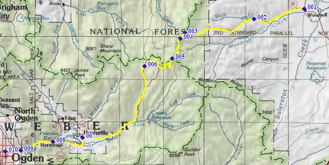 Approaches From East. Woodruff has a small store that
looks like it might have some groceries. Ut16
heads west towards the low sage brush hills. The
turnoff to Birch Creek Reservoir is located after
the initial foothill turns and has nice campsites.
There are few unique landmarks, where the road
negotiates the sage brush hills towards the ridge
line. In a deeply forested section the road passes
the Monte Cristo campground and ranger station. As
the road turns south it periodically opens up
views north to the Bear River Range. During the
summer months these are obscured by haze.
Approaching the summit the road traverses around a
rounded knoll - Monte Cristo Peak - calling this a
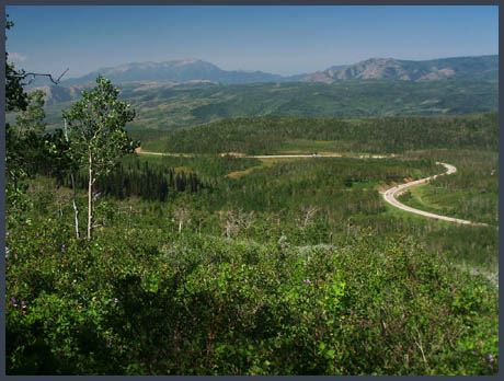
peak is a stretch of the imagination. From West. (described downwards). Where
the road goes beneath a power line, a few lower
meanders of the road come into view, in the
background the Wasatch Valley and Wasatch Range,
which are barely higher than the vantage point. A
shallow descent goes through juniper forest.
Following the South Fork of the Ogden River into
Huntsville, the road passes by numerous National
Forest campgrounds, hopelessly overcrowded
during busy summer times. The profile continues on
the most direct way down through Ogden Canyon into
Ogden. Signs discourage cycling along this route,
but do not prohibit it. For a more pleasant route,
climb over North
Ogden Pass. Dayride with this point as highest
summit: Ut39 Monte Cristo s(u) x2: camping
spot near jct rd to Birch Creek Reservoir - Ut39,
a few miles west of Woodruff <> Ut39 Monte
Cristo S(U) <> Huntsville with a few miles
around town: 86 miles with 5600ft of climbing in
6:4hours on a hot July day (Vetta 100A
r3:10.7.16).
back to cycling Utah's summits and passes |
||||||||||||||||||||||||||||||||||||||||||
|
|
advertisement |
|
|
advertisement |