| |
| |
Salt Wells Rd s(u)
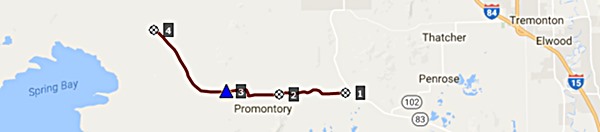
The Promontory Range is true to
its name. It extends like a finger into the Salt
Lake. There is surprisingly little public land
accessible here. Roads only cross the part of the
range that extends north of the lake. This road is
a gap in the Promontory Range between Locomotive
Springs and Bear River Bay. It is also the highest
point on a ride, that also goes over Promontory
Summit railroad grade.
 Approaches
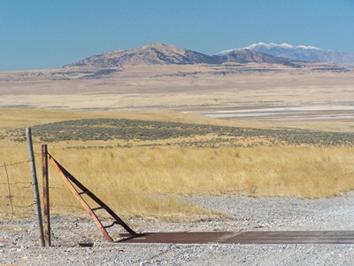
From West. (described
downwards) The Great Salt Lake comes into sight at
the top, beyond the reach of endless grassy plains
and a number of trees that can be counted with
fingers - gentle snow covered ranges in crystal
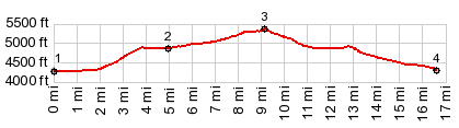
clear background. The descend comes in two steps.
At the end of the second step the profile for Promontory
Summit(sh) starts. 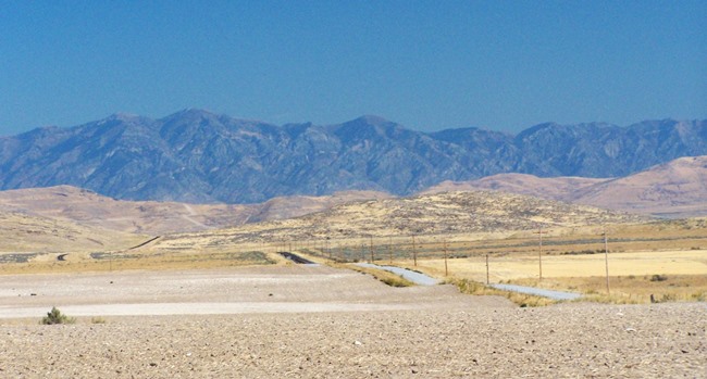
 Dayride with this point
as highest summit: Dayride with this point
as highest summit:PARTIALLY PAVED / UNPAVED: ( < FR538 Oakley - Rogerson Rd s(u) | Promontory Summit(sh) > ) Salt Wells Rd s(u) , Promontory Summit(sh) : near jct BLM Railgrade byway - Salt Wells Rd > BLM Railgrade byway south > West Grade autotour route north > N Golden Spike Loop Rd north > Promontory Summit Visitor Center > Promontory Summit(sh) > East Grade autotour route > Deep Fill Trail > Ut83 south > Lampo Jct > Golden Spike Dr west > East Grade autotour route west > Promontory Summit(shp) > Salt Wells Rd west > Salt Wells Rd s(u) > back to starting point on BLM railgrade byway: 49.0miles with 1950ft of climbing in 4:34hrs (garmin etrex30: m5:17.9.27). |
|
|
advertisement |
|
|
advertisement |