| |
| |
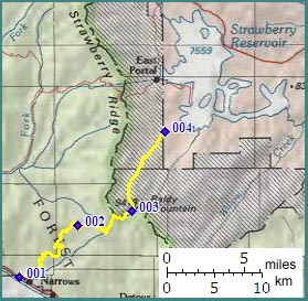
FR042 Strawberry Ridge s(u)
This road is like a
continuation of Skyline Drive on the south side of
the Soldier
Summit road, and this is a good reason to
expect some pretty phenomenal far views. This road
climbs the plateau again from the Soldier Summit
road, this time in the form of an initially paved
road, stringing together plateau viewpoints onto
the Wasatch fault blocks along the way. The road
is marked with a pass symbol on old Touraide maps,
and therfore I included with the "official
summits".
From South. The initial climb is paved,
and even smoothly paved, not the sort of
deteriorating quilt patchwork, applied for
centuries over older patchwork paving, that is
common in many parts of Utah. The exceptional low
traffic makes this a great road cycle too. But as
usual, the price for this is having to turn around
where the pavement ends. The paved road continues to the shoulder summit
on Ray's Valley Road. With a mountain bike
the route to the FR042 summit turns right off the
paved road at a parking lot with views of the
valley. Often a camper or two are parked here. The
best views are yet to come. With each traverse
that FR042 climbs, new stretches of previously
traversed road become visible below, making up new
middle ground in progressively vaster panoramas.
The road demonstrates one interesting feature of
many Utah landscapes. Climbing a forested plateau,
you often find yourself at eyelevel, or even
higher as sculpted alpine peaks across the valley.
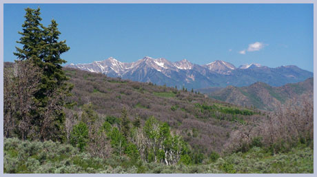
In this case it is the southern part of the
Wasatch Range including Mount Nebo (11877ft) and
Mount Santaquin (10685). Eventually the road winds around knolls of aspen
groves. FR043 (not the FR043 described here)
diverts to the right near the top, reaching a
higher altitude on yet another unrecognized
summit.
From North. (described downwards). At
the summit the surface becomes more oriented
towards heavy automobile traffic, even if the
traffic doesn't exist. The surface incorporates
angular stones with 1/2 to 1 inch diameter, not
exactly meant to attract bicycle traffic, to put
it mildly. The descend is lke a straight runway
ramp, flanked by aspen forest, which gives way to
grassland, eventually flowing into the spider like
shoreline of Strawberry Reservoir. What a change
in scenery ! The road around the reservoir is
paved.
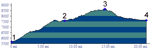
A Dayride with this point as intermediate summit is on page: FR131 Trail Rider Summit 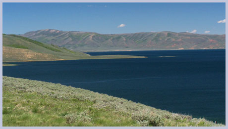
back to cycling Utah's summits and passes |
 Approaches
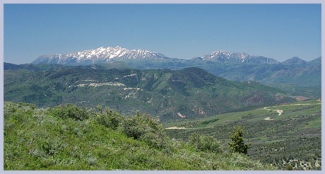
|
|
advertisement |
|
|
advertisement |