| |
|
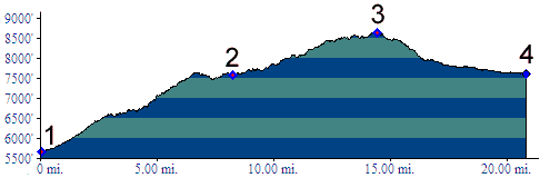
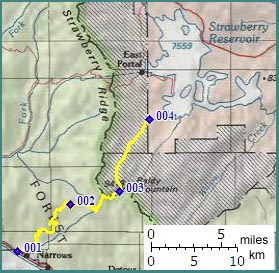
1.(5660ft,mile00) START-END SOUTH: jct US6 -FR101 Ray's Valley Road
2.(7590ft,mile09) profile turns right onto dirt FR042
3.(8630ft,mile15) TOP: point of highest altitude on Strawberry Ridge
4.(7610ft,mile21) START-END NORTH: Indian Creek crossing on south end of Strawberry Reservoir.