| |
| |
FR018 summit(u): Red Cloud
Loop
As Utah skylines go, the Uinta
Mountains seen from Vernal are inconspicuous. You
have to look closely to see a pancake like layer
of rock and snow reach above the treeline on the
horizon. It is nothing like the massive billowing
rock outcrops and layered cliffs near Dinosaur
Canyon, just a little to the east. But the Uinta
Mountains are a much larger landform than the
cliffs of Dinosaur Canyon, and a ride around Red
Cloud Loop will confirm this.
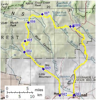
From East. The various turnoffs from US40
onto the Red Cloud Loop road are signed. The first
step in the staircase is Dry Canyon. Occasional
farms and vacation houses are interspersed between
crème colored cliffs. The road emerges onto
a sweeping grass landscape and climbs onto a
second step, a forested canyon. The pavement turns
to gravel, near the junction with FR051. After a
section of gravel, the surface improves to a hard
dirt, that is perfect for fast aerobic mountain
biking (road conditions Jun/07). A long gradual
climb leads closer and closer to the eastern
terminus of the rocky high Uinta ridge. The road
remains in a cultivated needle forest. The part of
highest elevation is near the turnoff to Sim's
Peak onto FR037. from West. (described downwards) The road
makes a loop over the plateau. It crosses the
same, shallow divide again twice in the same
process. This way the road descends on the same
side of the water divide as the ascent. A
long rolling way down leads through countless
meadows. On one of these I surprised a whole herd
of elk during mid day, and they surprised me even
more. There are a few unexpected uphills along the
way. About three miles before the junction with
Ut301 (Uinta Summit),
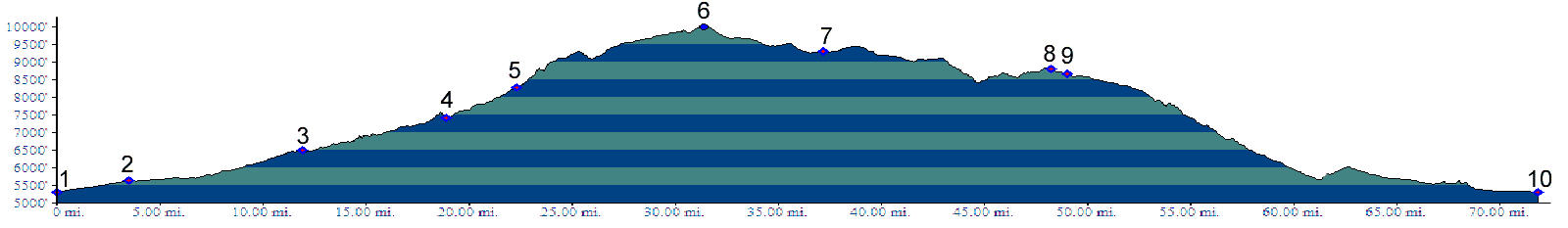
the surface becomes paved for a quick descent. Dayrides. A loop around the described
approaches measured 74 miles with 6300ft of
climbing in 6:4 hours, (VDO MC1.0 m3:7.06.15). 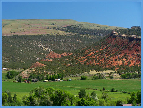
back to cycling Utah's summits and passes |
||||||||||||||||||||||||||||||||||||||||||||
 Approaches
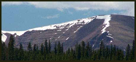
|
|
advertisement |
|
|
advertisement |