| |
|
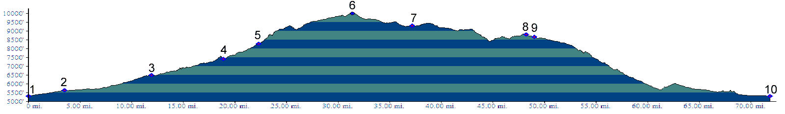
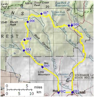
01.(5310ft,mile00) START-END SOUTH-WEST: Vernal: jct: Ut121-Ut44
02.(5630ft,mile04) turn right, following Red Cloud Loop signs
03.(6500ft,mile12) stay right up Dry Fork Canyon
04.(7400ft,mile20) stay right up Brownie Canyon
05.(8260ft,mile23) stay right, climbing above Brownie Canyon
06.(9975ft,mile32) TOP: turnoff to trail towards Simms Peak is on right
07.(9300ft,mile37) profile continues right
08.(8750ft,mile48) stay left
09.(8600ft,mile49) turn right onto paved road to East Park Reservoir. Jct wit Ut44 follows after 2 miles
10.(5310ft,mile72) START-END SOUTH-EAST: same as point 1