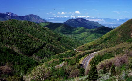
Big Mountain Pass
The road over Big Mountain Pass and Little Mountain Summit
is the perfect cycling route leading straight into
downtown Salt Lake City. The route over Little Mountain
Summit parallels the interstate along Parley's Summit and
therefor usually carries little traffic. During a week in
May/05 the road was not only used by many cyclists but
also roller skiers training for the next winter.
Both summits can be approached separately. But that option
involves riding a stretch on the shoulder of I80 through
Parley's Canyon. The profile shows the most logical
cycling route, which leads over the double summit. Both
summits are signed with name and elevation.
|
1.(5790ft,m00) START-END EAST:
junction Ut66 - Big Mountain Pass road (Ut65).
2.(5730ft,m05) START-END EAST ALTERNATE: south end
of East Canyon Reservoir
3.(5790ft,m06) dirt road up East Canyon leaves on
left
4.(7420ft,m11) TOP: Big Mountain Pass
5.(5990ft,m17) paved road on left connects with I80
and Parley's Canyon. Profile turns uphill on right.
6.(6227ft,m19) Little Mountain Summit
7.(4960ft,m22) START-END WEST ALTERNATE: "This
is the Place State Park" at the entrance to
Emigration Canyon
8.(4750ft,m23) profile turns right onto Foothills
Drive
9.(4240ft,m32) START-END WEST: Pioneer Park, Salt
Lake City
|
Approaches
From West. A substantial amount of climbing is
already involved when climbing up the benches of the Wasatch
Range to the entrance of Emigration Canyon. Salt Lake City
shows its most attractive side when seen in this large
landscape context. The entrance of the canyon features a state
park, explaining the importance to Mormon history of this
magnificent entrance into the Salt Lake Valley, and also a
high rise apartment complex with an array of microwave
antennas. The last gives the area a surprising big city look.
In contrast - the climb up emigration canyon has a rural feel
for being so close to the heart of a city. A switchback climbs
above treeline and crests at Little Mountain Summit. It is
only a short downhill to the climb up Big Mountain Summit.
Here the route deviates from its parallel course to I80. Most
of the climb is in forest. At the summit the route crosses a
path, which at this point is designated both the Great Western
Trail and the Wasatch Crest Trail.

From East. The climbing starts in earnest just past East
Canyon Reservoir. The road has little or no
shoulder, but traffic is generally light. This is especially
true in spring before the motoring public has discovered that
the road is open. (May/05).
Tours
Dayrides. An out and back dayride starting up the
eastern approach from East Canyon Resort (on East Canyon
Reservoir) into Salt Lake City, with somewhere around 10 miles
of touring around the city, measured 71 miles with 5811 feet
of climbing, using a Vetta 100A cycle computer.
|