| |
|
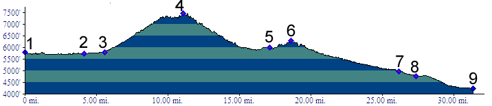
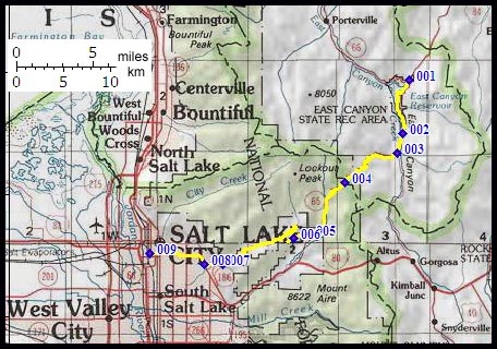
1.(5790ft,m00) START-END EAST: junction Ut66 - Big Mountain Pass road (Ut65).
2.(5730ft,m05) START-END EAST ALTERNATE: south end of East Canyon Reservoir
3.(5790ft,m06) dirt road up East Canyon leaves on left
4.(7420ft,m11) TOP: Big Mountain Pass
5.(5990ft,m17) paved road on left connects with I80 and Parley's Canyon. Profile turns uphill on right.
6.(6227ft,m19) Little Mountain Summit
7.(4960ft,m22) START-END WEST ALTERNATE: "This is the Place State Park" at the entrance to Emigration Canyon
8.(4750ft,m23) profile turns right onto Foothills Drive
9.(4240ft,m32) START-END WEST: Pioneer Park, Salt Lake City