| |
| |
Nv158 Mt Charleston Loop s(u) The beauty of Las Vegas - if you
ask me - lies in the contrast to its natural
setting: a bowl of derlict gambling hotel
skyscrapers, surrounded by in some (definitely
not all) places pristene dessert mountains.
You can even go skiing not so far from Las
Vegas. This loop road leads up into this area.
The Spring Mountains are still covered in snow
in mid April.
 From South.
(described downwards) Soon after the summit
the only "normally sized" panorama on the loop
comes into sight. It is nicely proportioned view
of the road below, with snow covered ridges
reaching Mount Charleston, and -Lord Behold- in
order to get down there ,there has to be at
least one more curve resembling a switch back,
-and there actually is such a large radius
switchback. The road makes one final change in
direction at the junction with Nv157. Here
another possibility for an out and back climb,
shorter and lower than the on one the other
side, lends itself to reach the Mt Charleston
trailhead. Continuing downhill from the
junction the road passes a big hotel complex,
worthy of any and all Las Vegas abominations. It
is amazing to think, that this planar looking
landscape still has over 3000ft of elevation to
give up on this decent. In some ways it looks
like the badlands of Nebraska, but there a human
powered bicycle doesn't speed along at 47 miles
an hour without any extra energy from pedalling,
because there the plane is not inclinded, and
the strong downslope winds do not exist. As the
name "Kyle Canyon" may lead to suspect, the road
soon follows a small ravine with soft sandstone
outcrops lining the straight dry stream bed. The
final approach to the lowest area in the valley,
on I15, takes more distance than suspected. But
the miles flow by quickly on the last part of
this super smooth alluvial fan.
Sidetrip to Las Vegas Ski
Bowl
This out and back on the northern approach comprises another 930ft of climbing reaching the top parking lot of the ski area, making it roughly 200ft higher than the two way summit. There is no view from the end of the road. But according to the map a trail starts at the end of the parking lot. I missed it.
 Dayride with this point as
highest summit: Dayride with this point as
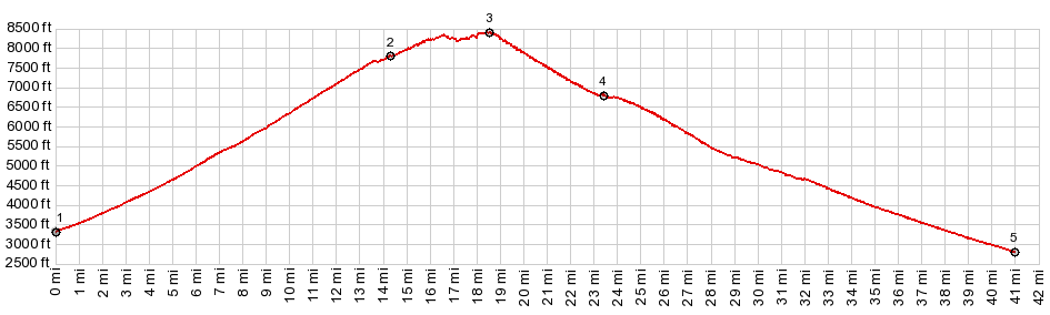
highest summit:COMPLETELY PAVED ( < unmarked summit1 west of Saint George | Mormon Pass > ) Nv158 Mount Charleston Loop s(u) , additional out and back : jct I95 -Nv156 > up Nv156 > jct with Nv158 <> out and back to top parking lot of Las Vegas Ski Resort >> Nv158 south > Nv158 Mt Charleston Loop s(u) > Nv157 east > I95 north back to starting point: 62.7miles with 6760ft of climbing in 5:47hrs (garmin etrex32 r4:23.4.12) Notes: last part on I95 is signed as closed to bicycles. However some distance later (more northern) exits are not signed that way. In any case - safer than most US highways 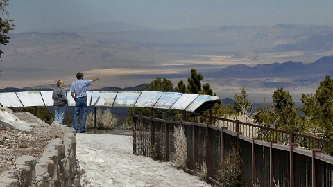 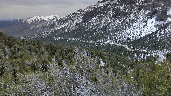 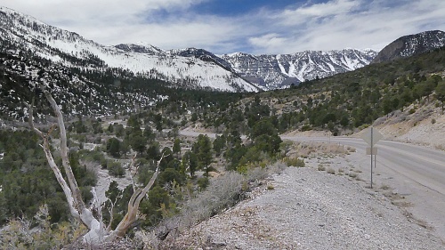 |
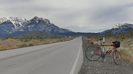 Eventually the cacti
thin out, and the road leaves land belonging to
a BLM conservation status, into less restrictive
National Forest land. Eventually gaining enough
elevation, stunted evergreen bushes start to
line the road. Before NV156 can make it all the
way to the ski area. NV158 branches off in what
is the closest thing to a switchback, that this
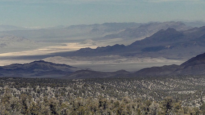
loop has to offer. Now traversing below the
rocky top ledges of Mt Charleston, the dessert
vista spreading east is immense, a truly
supersized panorama, and in April the air is
usually clear enough, so that the immensity can
even be appreciated..A couple of parking lots
invite motorized ,visitors to exit their metal
enclosures to look around. The top is marked
with a simple summit sign stating 8427ft.
Eventually the cacti
thin out, and the road leaves land belonging to
a BLM conservation status, into less restrictive
National Forest land. Eventually gaining enough
elevation, stunted evergreen bushes start to
line the road. Before NV156 can make it all the
way to the ski area. NV158 branches off in what
is the closest thing to a switchback, that this
loop has to offer. Now traversing below the
rocky top ledges of Mt Charleston, the dessert
vista spreading east is immense, a truly
supersized panorama, and in April the air is
usually clear enough, so that the immensity can
even be appreciated..A couple of parking lots
invite motorized ,visitors to exit their metal
enclosures to look around. The top is marked
with a simple summit sign stating 8427ft.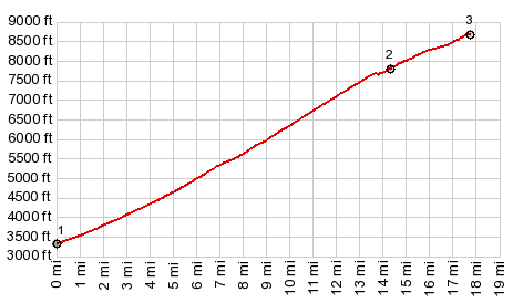
|
|
advertisement |
|
|
advertisement |