| |
| |
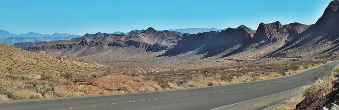
Lake Mead North Shore Rd
s(u)
I always thought of Lake Mead as a
place, where people like to sit on boats and sip
martinis. I didn't think of it as a cycling
paradise. And in the view of many - that's not
really what it is either, but the very least it is
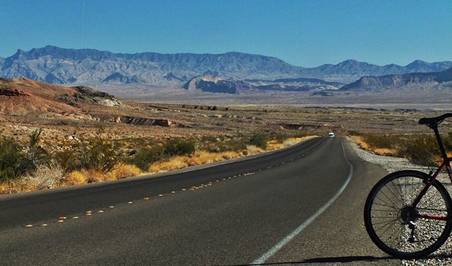
- a really pleasant surprise for road cyclists. Granted - there is only one road,
and there are no facilities or signs of businesses
or people along the way. But that can be a good
thing (depending on the people and businesses).
Traffic exists, but it is extremely light. I was
there in the end of October and the weather
couldn't have been more perfect. It never
precipitated. If it is not so perfect, it makes
itself felt in the form of strong wind. This road
is paved as if somebody was planning to run a
cycling time trial over it - much smoother than
state maintained roads, and the scenery is beyond
this world. There are good shoulders. Even though
they have a kind of rumble strip, you can ride on
top of them, and they feel smoother than 90
percent of all US paved roads without rumble
strips. I have never seen these kinds of rumble
strips on any other roads. Of course no rumble
strips would still be better. But let's be
realistic, this is America.
Approaches
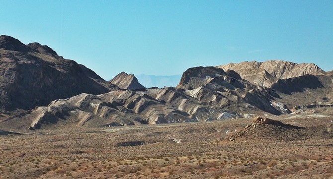
From South. (described
downwards). The rocks from this perspective seem
to have originated from an architectural designer
with a special sense of form, color and variety.
Geologists may see it differently, but will agree
on the color, form and variety aspect of the
statement. After that each 200ft dip seems to give
way to a 150ft climb. At the next major bottom
another stream of sand gives the impression that
it has been a long times since it rained, but when
it does it pours: Calville Wash.
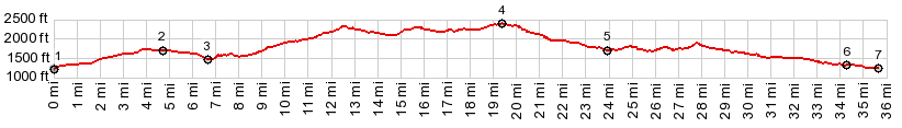
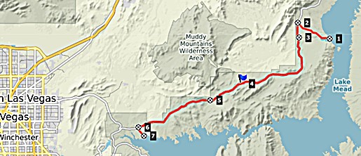
Dayride with this point as highest summit: COMPLETELY PAVED (< Valley of Fire Rd s(u) | Aniversary Mine s(u) > ) Lake Mead North Shore Rd s(u) x2: mesa a couple of miles south of Overton <> Lake Mead North Shore Rd south <> Lake Mead North Shore Rd s(u) <> turnaround point just before the jct with West End Wash Rd with short additional out and backs: 74.5miles with 5010ft of climbing in 6:12hrs (garmin etrex30 r4:19.10.29). |
|
|
advertisement |
|
|
advertisement |