| |
| |
Lake Mead Boulevard s(u)
This is the scenic way to enter Las
Vegas from the east - through a gap in the Sunrise
Mountains. Early light is also the time of the
best views of the improbable city.
Actually - it transforms into a 2 lane road. A
short portion over the top has no shoulder, and
that is the first time along the entire ride, with
reason to worry about traffic. But it is a very
short section. Here the sides of the road are not
just lined with garbage, they are filled to
capacity with garbage. A million different shards
of glass and metal glisten in the sun, in between
the Bud Light cans and the plastic bags, formerly
containing chips of some sort. At the top two
steep tracks take off in both directions, to
points above on the bare Sunrise Mountain. 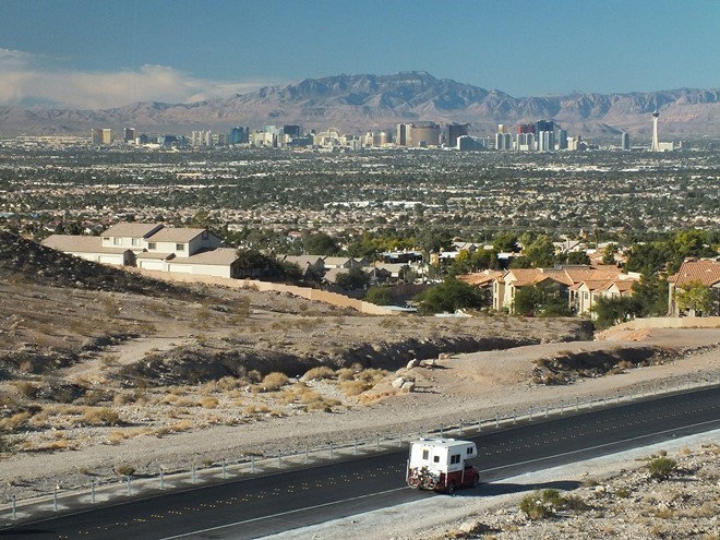
From East. (described
downwards) The road passes another access road to
the Sunrise Mtn recreation area. The BLM has
attempted to put up guardrails to keep the traffic
on the access roads. Now it looks like all the
trash dumps have been fenced off. The glass shard
shimmer next to the road become noticeably less,
as the road crosses a guard station into the Lake
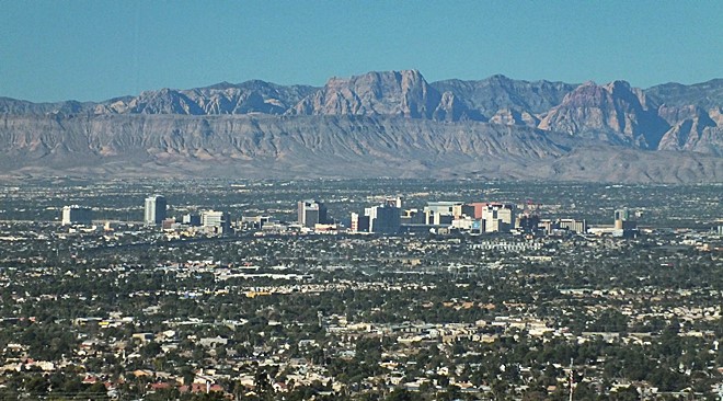
Mead Park. The air on this side of the mountains
is much clearer, and the wide washes reach to the
horizon, eventually reaching the Muddy Mountains.
Amazing dessert scenery on this side.
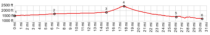
 Dayride with this point as highest summit PARTIALLY PAVED / UNPAVED ( < Aniversary Mine s(u) | Boulder City s(u) > ) Lake Mead Blvd s(u) , E Lake Mead Pkwy(sh): Government Point on Lake Mead > Gov Wash Rd north > Northshore Rd west > Olsen St north > Wetlands Trail west > Boulder Hiway and other roads north and west > Sandhilll Rd north > East Charleston Blvd west > N Nellis Blvd north > E Bonaza Ave east > Mt Hood St north >Lake Mead Blvd east > Lake Mead Blvd s(u) > Northshore Rd east > Gov Wash Rd back to starting point:48.7miles with 2400ft of climbing in 4:20hrs (garmin etrex30 m3:19.11..1). 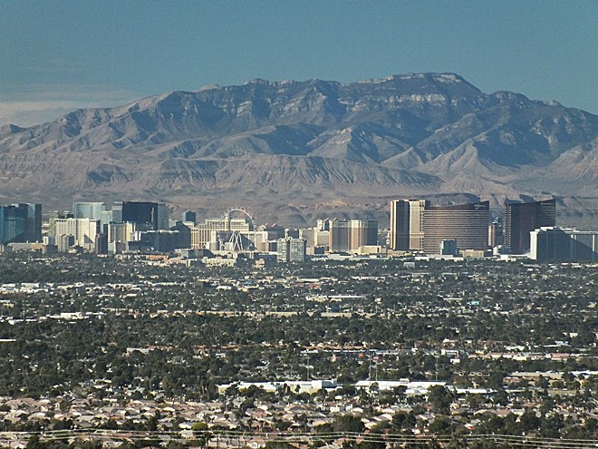 |
|
|
advertisement |
|
|
advertisement |