| |
| |
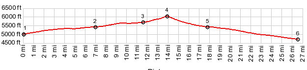
Goldfield Summit I95 rises from 1500ft in Las Vegas, intermittently and ever so gently until it reaches roughly 6000ft on Goldfield Summit. This is not a 4 lane highway, but a 2 lane road, mostly with a wide shoulder and rumble strips, located exactly on the lane boundary, There may be sections north of Beatty where the shoulder situation is not so good for cyclling. But the profiled section, which I rode during a loop over Montezuma s(u) is -as far as I am concerned- safer than most 3 lane roads.
From South. (described
downwards). The road decends a couple of hundred
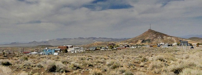
ft into strange Goldfield. There are a
surprisingly large number of houses here, but no
grocery stores, or anything else that does not
fall under the category tourist trap. It is
however a collection of pictursque decay,
touristically spruced up for the unengaged. On
this side is a high mountain park, of sorts -
really a desert plain, bottoming on a dry lake
bed, I95 decends barely 600ft, before climbing
again to get out of this saucer shape. But the
profile follows a paved road to a lower point in
the saucer along Silver Peak Road to where it
reaches a low point, before this road too climbs
out of the saucer. 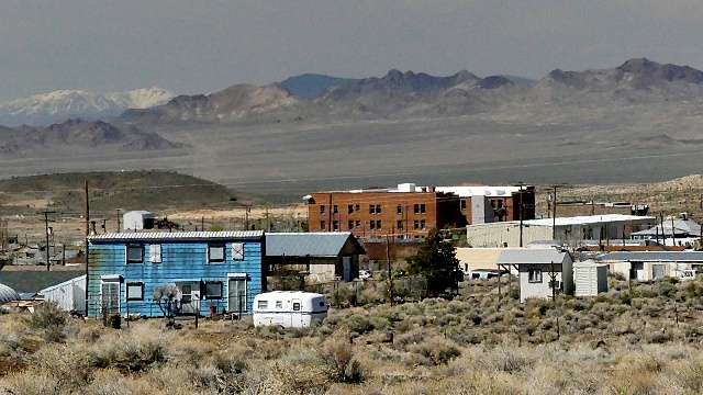 |
|
|
advertisement |
|
|
advertisement |