| |
| |
Baylor Pass
Baylor Pass offers a way to cross
one of New Mexico's most spectacularly scenic
mountain ranges, the Organ Mountains, with a
mountain bike. The trail is not maintained for
bicycling and is really more of a portage than a
ride. Still, taking a bicycle over this pass makes
a loop ride over this range possible. Life could
be a whole lot worse than hiking with a bicycle on
your back in magnificent dessert mountain scenery
like this.
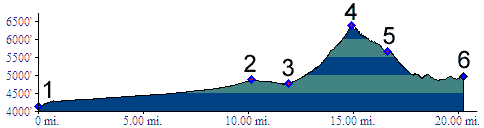
From North. The profile begins in Las
Cruces and follows the San Augustin Pass
route to the last I70 exit before the town of
Organ. The gap occupied by Baylor Pass is visible
from far down the frontage road of I70, as the
lowest gap in the range, somewhat to the south of
San Agustin Pass. But the canyon followed by
Baylor Pass angles up from the north, so that the
valley to be ascended does not become visible
until the final miles along I70. Turning right off
the I70 frontage road the surface becomes a
gravel, shortly before the Baylor Pass trailhead,
which comes complete with a parking lot and
"National Recreation Trail" sign. The 6 mile
single track trail is open to everything except
motorized vehicles. The first half mile of the
trail follows the final upper part of the alluvial
fan and is the best bet for a single track ride,
but even here frequent rock ledges have been
constructed across the trail to retard water
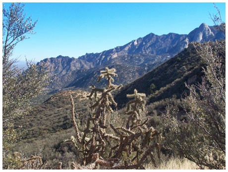
erosion. Beyond that much of the trail was a
portage for me, albeit a very scenic one between
cacti. The Dona Ana mountains, which make a jagged
outline from the valley, take on the shape of
large petrified dunes from this vantage point. The
vertical peaks on the south side provoke wonder
about weather these faces have ever been climbed.
The 2+1/2 miles to the summit go by quickly. More
frequent stretches of easily cycled single track
appear again within a mile of the summit.
From South. (described downwards). A
magnificent view of the peaks in the Organ range
to the south opens up just below the summit. The
paved road below appears tantalizingly close, but
the trail takes a detour to the south. When the
road appears closest a little later, the trail
takes one more little detour into the hills, which
necessitates shouldering the bike one more time.
The final 1/2 mile approaching the trailhead would
be a fast easy single track again, if it wasn't
for the multitude of erosional barriers
constructed across the trail. In all likelihood
these are fairly easily ridable for somebody with
more technical skill than me, but I don't think
the time savings would be significant. The trail
terminates on a one way loop road through the
Aguile Springs BLM area. The profile continues
along this one way loop road to the right.
Approaching the trailhead on the other part of the
loop yields a slightly different profile. A short,
steep rolling descent on a narrow road leads to
the low point along the route, with peaks
complimented by yucca cacti stalks in all
directions. From the low point it is only a couple
of hundred feet back up to join San Augustin Pass
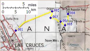
shortly before its summit. Tours Dayrides. (MTB+paved+portage): A loop ride with an additional, optional approach started in Radium Springs and continued > Las Cruces > Baylor Pass > Aguire Springs BLM area > San Agustin Pass > back to Las Cruces and Radium Springs, and measured 70 miles with 3100ft of climbing in 6:0 hours, on a sunny day with perfect temperatures between Christmas and New Year. Ride statistics were measured with a VDO MC1.0 cycle computer and do not include the portage which probably amounted to about 500ft of climbing in an hour (m3:07.12.30)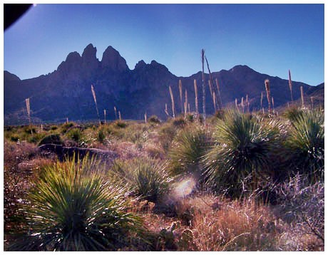
back to
New Mexico's Summits and Passes by bicycle |
 Approaches
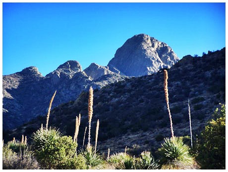
|
|
advertisement |
|
|
advertisement |