| |
| |
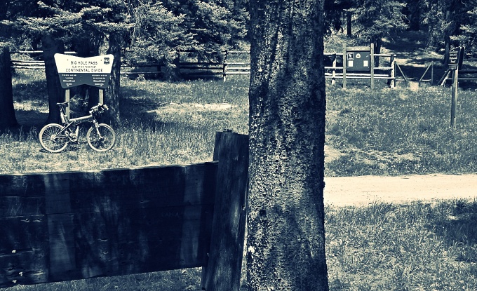
Big Hole Pass Montana has at least two Big
Hole Passes, that are not far away from
each other. This one is unpaved, and like
the parallel paved Chief
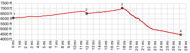
Joseph Pass, it has one shallow and
gentle approach leading up from a high and
dry mountain park, and another steep and
high approach from a deep forested valley.
From there a short pleasant
ride leads through a forest, ruled by cows
to a wood covered summit. Marshall Spraque
in the appendix to his all-compassing pass
history "The Great Gates", says that there
are fine views direction Oregon from here. I
didn't see any, though admittedly further
down the west side you can catch a glimpse
through the trees, onto hills direction
Oregon. But having my mind set for a
good view, which is generally the main
motivational force behind my pass rides, I
followed a dirt road from the summit south,
which here is also the Continental Divide
Trail, and within short distance, found a
reasonably good view of the south end of the
Beaverhead Range (picture below) 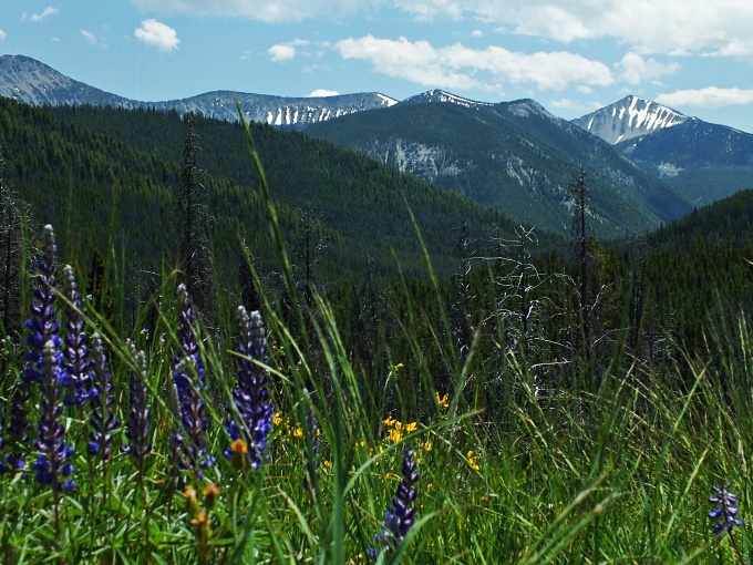 From
West. If there is a "Big Hole" on
this pass crossing it is definitely on this
side. The road does appear to be sucked down
into a green forested trough. There are not
many views. But the road requires several
traverses, switching back and forth down
into the bottomless green bowl. Montana's
other more famous Big Hole Pass is not far
away. I am under the impression that the
name for both passes, does not refer to any
geographic feature, but the nearby Big Hole
Battlefield. Gibbonsville is at the bottom
of the road, before joining US93. It is the
historic old town in this region, but only a
building, or maybe at the most two, hint at
any glory from past days, and as far as I
know, that maybe just reenactment from a
much later era. There are no businesses
here, not counting one (apparently) closed
lodging establishment
|
|
|
advertisement |
|
|
advertisement |