| |
| |
FR 408 - 421 summit(u):
German Dugway - Green Basin Road
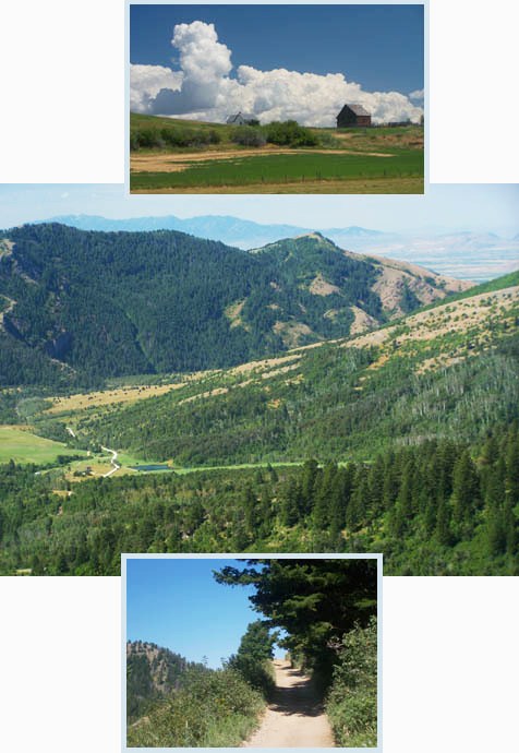
The Bear River Range reaches
north from northern Utah into southern Idaho. Here
at the northern end of the range in Idaho, it has
little of the unique scenic combination of
sculptured peaks combined with limestone canyons,
that makes the range so scenic in Utah. Instead it
is mostly a range of tree covered hills. But far
views into the valley and a great climbing workout
can still be had.
Approaches From West. The turnoff from Ut36 onto
Birch Creek Road in the town of Mink Creek is
signed. If approaching from the west it's shorter
to take Capitol Creek Road. Mink Creek road turns
to dirt at a large snowmobile parking lot and
crosses into the Cache National Forest. A fairly
good dirt road leads up a forested canyon and
crests at a cow grate. Immediately after this
summit the route turns left onto a double track
trail, labeled German Dugway Rd on Gazeteer maps.
There is no sign at the turnoff. This trail is
very rideable - not too steep, not too rocky, with
a couple of short exceptions. Views down to
Franklin turn into views of Cache Valley, with
Bear River Gap - the far away low ridge through
which Bear River makes its final break to the Salt
Lake - clearly visible. The track switches back
towards the north and aims for the same gap in the
range as a power line that crossed Birch Creek
Road earlier. 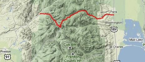
From East. (described downwards) On this
side the road is in better condition. There is an
elaborate camping spot on top. From here on the
road carries the number FR421 on maps and is
called Green Basin Road, even if no signs attest
to this. A gradual descent through pine forest
leads to a high mountain park named Paris Flat.
Signs point to an ice cave, in which (according to
the sign) ice can be found year round and parents
should watch their children. The forest slowly
gives way to sage brush and is now known as Paris
Canyon. The road surface turns more gravelly. This
side is easier to descend than climb because of
road conditions. Pavement is reached as the road
rolls into Paris, located a few miles north of
Bear Lake. The town has an interesting church of
sorts, not Notre Dame as in the other Paris, but a
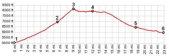
historical Mormon tabernacle. Dayride wth this point as highest summit: Near lower end of Beaver Creek Road, located near town of Mink Creek > up FR407 Beaver Creek Road > up FR408 German Dugway > FR408-421 summit(u) > down Green Basin Road > Paris > Ovid > Id36 summit(u): Williams Canyon > Mink Creek > back to starting point: 56 miles with 4600ft of climbing in 4:55 hours (m3:10.7.31). |
|
|
advertisement |
|
|
advertisement |