| |
| |
Border Summit
In Utah and this part of Idaho
some very low summits are named and marked with a
summit sign. In this case the reason is
historical. The summit was once on the California
Gold Rush trail and informational tablets along
the road side tell the story.
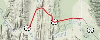
Approaches From West. From its junction with
Wy89, US30 barrels straight west up a hill on
Boundary Ridge. But first it crosses Thomas Fork,
where a sign relates a story of early capitalism
along the California Trail ( more below ). About
halfways up the straight approach is a rest area.
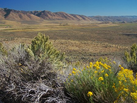
The top is a road cut. But just a few steps
further on the old abandoned highway on the right
waits a great view of the Sublette Range and the
swampy Bear River at its foot (picture beolow). It
gives the appearance of having climbed much more
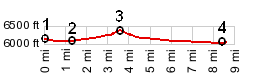
than was actually the case. From East. (described downwards). The
descend seems even smaller than the other side,
even if the profile shows them to be about equal.
Maybe the reason is the lack of a vista on this
side. It's just a short roll down a grassy ravine
on the way to Geneva Tours Dayride with this summit as shoulder point: Geneva Summit : Montpelier > Geneva
Summit > US30 south <> short out and back
to Raymond > Border Summit > Bench Road >
back to starting point: 50 miles with 1600ft of
climbing in 3:4hours (r2:10.9.17).
Oregon Trail: In 1849 California gold
seekers started using a short cut to the Oregon
trail, that roughly followed today's US30 across
Border Summit. On the lower west side the road
crosses Thomas Fork. By the early 1850s two toll
bridges had been built to cross the stream. The 1
dollar per wagon fee was quite high for the day,
and many poorer emigrants still struggled to cross
the stream. for free. During the early trail days the difficult climb
along the route was not this little summit.
Instead the road crossed something called "Big
Hill", visible from US30 a few miles east of
Montpelier. At least one emigrant noted in his
diary, that this was the most difficult hill to
cross on the entire Oregon trail east of Fort
Hall. Enterprising emigrant Tom Mc Auley soon
built a toll road through the gully south of this
hill, following today's US30. The road was not
maintained after 1852 and fell again into disuse
|
 History
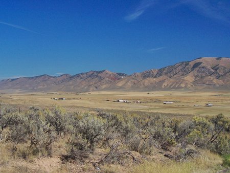
|
|
advertisement |
|
|
advertisement |