| |
| |
Banner Summit
The official Montana and Idaho state
maps with the states' major highways contain many
designated summit points. Many of these are wide,
gentle water divides. These summits are located
either at nondescript points in the forest or in a
spread out mountain park with peaks somewhere on
the horizon. This is one of the former. It makes a
great workout, and on the west side there is not
much there that could persuade you to stop. The
profile continues all the way around the Sawtooth
Range, over something called Blind Pass and down
the other side to the Salmon River. All the
interesting and amazing places - in my opinion -
except one, are on this gentle decline on the
right side of the profile below..
But we'll start back in Lowman. A highway leads
through the forest, following the South Fork of
the Payette River. The road bed has been cleared
wide enough, so that between 12 am and 4 pm in the
summer, there is not an inch of shade on the road,
in spite of the fact that there is no shortage of
trees. After many miles the Sourdough Lodge has an
opportunity to refill water bottles and even
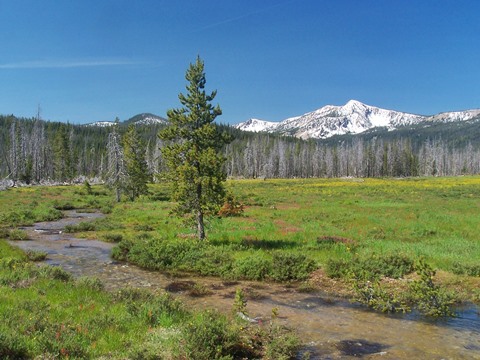
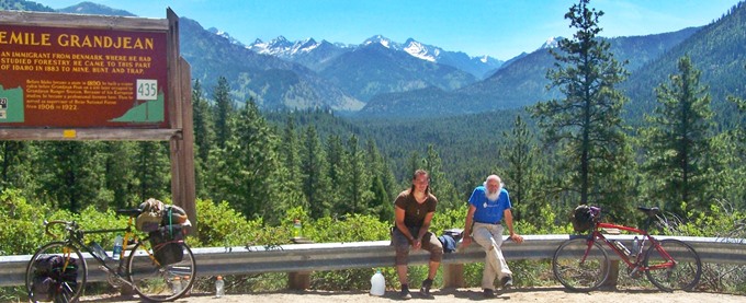
increase the tire pressure with an air hose. Many miles later an actual noticeable slope
begins. A short distance up the climb is a pullout
with the aforementioned singular view on this side
- a few peaks of the Sawtooth Range appear through
an opening in the forest. A historical tablet
extolls on the virtues of a forest ranger from
Denmark, who became the first ranger in this area,
due to his European forestry education. I met two
interesting travelers resting at this spot. The climb continues without turns that would
cause any traffic to slow down the slightest bit -
the countless nearby trees, just not nearby enough
to give shade. The summit offers a diversion. A
sign announces that the name of the National
Forest changes from Challis to Boise. A designated
"rest area" consists of a parking lot where
people, pulling there speed boats stop to check
their bungy cords, to ensure that the boat will
not fall off at 65 miles per hour. There is a
homemade looking summit sign with the elevation
labeled as 7200ft - a large margin of error -
"maybe a leftover from when these elevations were
still measured by triangulating stars" - I
thought. The heat was getting to me.
From East. (described
downwards) A gentle descent leads ~460ft lower
around the north end of the Sawtooth Range. Here
one can follow one of two creeks up stream on
unpaved roads. The paved road does this for only
~200ft to something called Blind Summit. This
elevation is signed with exactness as 6713ft. By now you may have given up on this summit. But
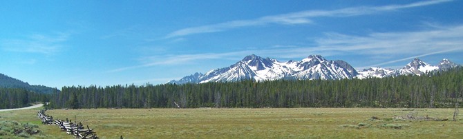
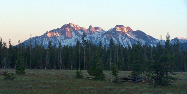
a few miles later the first views of the Sawtooth
Range appear. - Very aptly named, but I called it
the Sawblade Range many times by mistake. Maybe
that describes the ragged rocky outline in snow
even better. The road cuts through the scenery
like a wide black ribbon. But now there are views
to thrill the eyes for many miles. This type of
scenery lasts to Haley. The profile continues
through this town and follows the Salmon River all
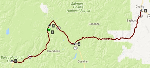
the way downstream Challis. A Dayride with this point as highest summit: COMPLETELY PAVED: ( < Galena
Old Toll Rd Summit | FR487 Squaw
Creek Rd - Seven Devils Rd(sh) > ) Banner Summit x2 : campsite near jct Elk
Meadows Rd - Id21 north and then south around
north end of Sawtooth Range <> Banner Summit
<> turnaround point on Id21 about a mile
past the Sourdough Lodge: 80.0miles with 4270ft of
climbing in 6:22hrs (garmin etrex30: 17.6.30)
|
|
|
advertisement |
|
|
advertisement |