| |
| |
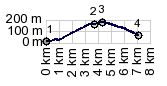
Col de St Ignace via Sarre
s(u)
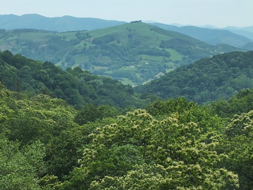
The mountain "La Rhune" is a very
recognizable landmark from the Basque Corniche in
France. A nice bike ride loop goes around this
mountain, leading over three very small passes. Of
those, this is the only pass on the French side.
It is also the lowest, and the take off point for
hundreds of tourists to take the cog railway to
the top of their mountain, looking down on Spain.
The actual summit comes after the pass, just
after the commerce. A third road meeting near the
railroad station also crosses a higher point. From South. The
descend to Sarre is only 120 meters, but there are
ways to get lower in the landscape back towards
the coast from there.
 |
|
|
advertisement |
|
|
advertisement |