| |
| |
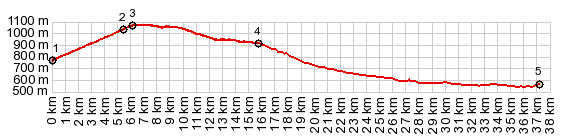
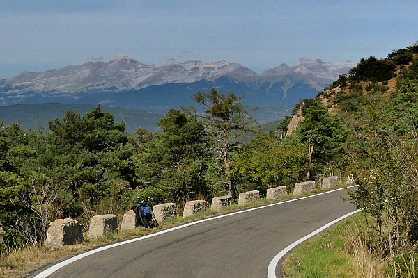
Puerto de Oroel This seems like the first obvious
cycling goal from the Jaca area. The road heads
towards that bombastic hogback ridge, standing
in complete isolation to the Pyrenean system of
ridges, yet obviously connected to its geologic
history, and the perfect vantage point onto it.,
should one get on top of it. On the ridge top a
prominent cross makes it obvious that this is a
popular weekend hiking goal.
Some distance before reaching the
pass a side road goes to the Parador de Oroel.
From there a hiking trail climbs to the top. The
parador itself is a really nice vantage point over
the ridge. Just as a side note: the parador road
continues to traverse Monte Oroel in the form of a
rough and wavy, but paved forest road, apparently
connecting to other pavement to the east. From North. (described
downwards) A fairly rough road descends in a
million curves through a maze of gentle rounded
forested hills. Before reaching Bernues, taking a
right makes for perfect short Jaca day ride over Monastario San
Juan de la Pena. But the profile stays left
and decends to the river Gallegos.
|
|
|
advertisement |
|
|
advertisement |