The main attraction of this summit
is not the summit itself. Neither is it
reflected anywhere in the name, and it came as a
complete surprise to me. Nor was anybody else
around to either share or deflect from my
enjoyment of this place while I was there. It
seems to be one of the more out of the way
places in the Pyrenean foothills, at least in
the month of May: the old village Peramea.

Approaches In this village a tiny road, that looks like a
driveway between two hedges heads to Montcortes.
The road climbs on dry slopes, following every
single contour of the landscape, no roadcuts
whatsoever on this little path. It's a fairly
undistinctive group of rolling hills with brush
forest, that makes up this scenery, but in the
distance is a peculiar knob, that I recognize on
the Panoramio pictures, and also remember in
nature. Climbing onto a rolling plateau, the road reaches
a sedate vacation lake. Curiously this lake is the
top, even if -at first view, it remains a mystery
where the water flows down from. This is the
Estany de Montcortes. The roads to the right here
all dead end. But staying left, the profile goes
just a few meters higher, just after passing by
the couple of old farmhouses that make up the
village Montcortes
From East. (described
downwards). But all the good stuff on this ride is
still to come on this descend. Peramea first shows
up much like in one of the photographs in the
slide show. I took quite a bit of time to find the
perfect vantage point on this row of houses
myself. But it is possible that the very nicely
composed slideshow pictures were taken a small
distance away from the profiled road. In any case
the scene is similar. The road crosses perpendicular to the little
ridge that Peramea sits on, and crosses it as the
narrowest spot, much like a miniature pass by
itself. I don't remember having seen more than
maybe four cars up to this point, and walking
through the village was another experience where I
could enjoy more absence of tourists. A series of
tiles on the water fountain greet the visitor. The
axis of the town is quickly walked, and I
recognize all the scenes from the photographs.
There is just one really scene that I cannot find
anywhere. On the north end of the village a small
cliff abruptly terminates the village. Between
here and the next cliff on the other side. Down
below a group of cattle foraging in the dirt
separate the village from a walled in cemetery. It
is the strangest cemetery I have ever seen. It
seems like you would have to wade through a yard
of cow manure in order to visit a grave. But maybe
there is a hidden entrance in the back somewhere.
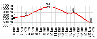
A Dayride with this point a highest summit: COMPLETELY PAVED: ( < La Paquera s(u) | Collado de Creu de Perves > ) Estany de Montcortes s(u) , additional out ad back : La Pobla de Segur > Senterada > La Pobleta de Bellvei with short detour > Estany de Montcortes s(u) > Peramea > N260 north > Baro <> out and back to Tornafort with short sightseeing detours <> separate out and back towards Soriguera to turnaround point that meets with with ride r5:19.5.19 > N260 south > back to starting point in La Pobla de Segur: 64.3m wirth 5702ft of climbing in 6:09hrs. Notes: Even if it is completely paved the out and back to Tornafort is very rough in places A Day on a tour with this point as intermediate summit is on page: Collado de Creu de Perves |


| |
| |