| |
| |
GR3204 Pinos de Valle s(u)
This summit traverses along a ridge
between the Sierra Nevada and the coast. Like many
mountain roads in the area it has hardly any cars,
more curves than you might expect, and a great
surface due to generous EU infrastructure
expenditures. I don't think the aim of those funds
was necessarily to better the life of cyclists,
but they certainly have a nice roads for that
purpose here.
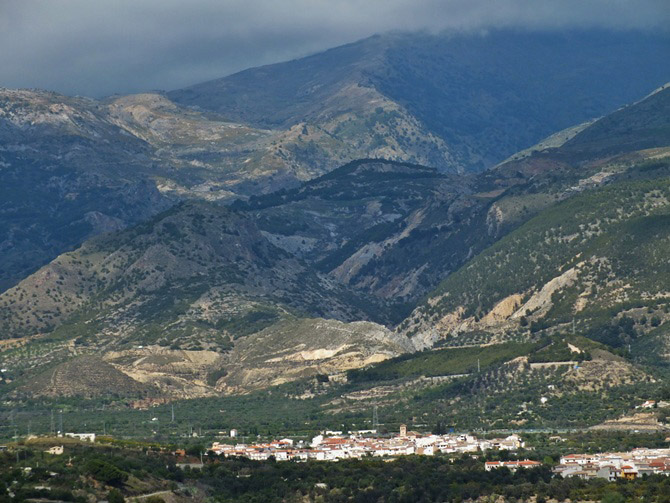
Even when every detail of the Sierra de la Chaba
gleams in crystal clear sunshine, the Sierra
Nevada often still has its head stuck in the
clouds. But even on the lower slopes of the range
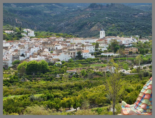
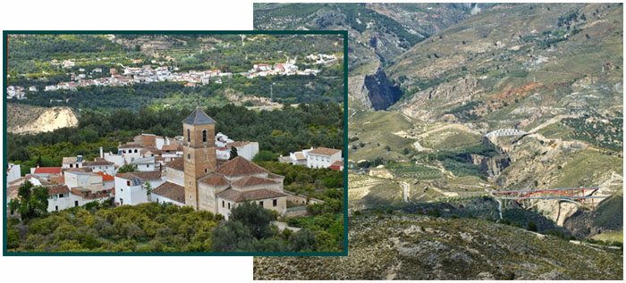
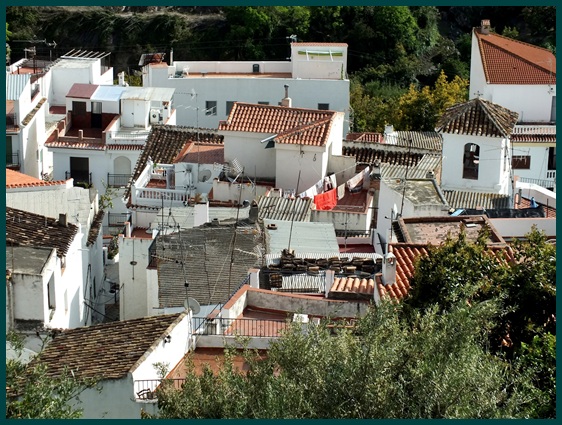
there is much to see: busy villages clustered
around white church towers, a variety of bridges
representing civil engineering art through the
centuries crossing the same ravine in proximity.
Through all of it cuts a 4 lane highway in
uncompromising simple geometry. Up here on this
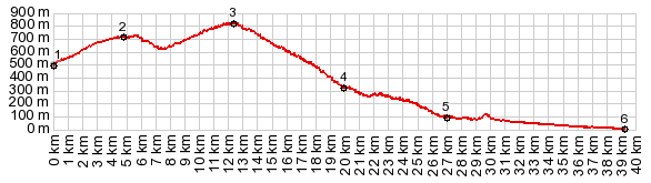
road life has more curves. The first high point (point 2 on the profile)
goes under an aqueduct and changes the viewshed to
the south. But then the road starts climbing
again. At the top is the first extensive view of
the sea, and a few trees are starting to appear at
this elevation Next to the road stand two ruins, an old mansion,
and a small castle like structure that could also
have been a "butler's quarters" of sorts. These
structures make the point easily identifiable from
adjacent summits and point below.
From South. (described
downwards) The long curvy roll made me loose my
sense of direction, so that in Larguit I started
heading back into the mountains, rather than
continuing the roll to the sea. At the bottom the road joins a larger coastal
road with a wide shoulder for cycling and cuts
across a limestone canyon. Soon after the village
Salobrena appears in view. A Dayride with this point as intermediate
summit is on page Carretera de la
Chaba s(u) |
||||||||||||||||||||||||||||||
|
|
advertisement |
|
|
advertisement |