|
|||||||||||||||||
|
|
|||||||||||||||||
| |
|
D32 La Tour s(u)
The summit came as a surprise to me. On a map it looks like
the highest point would be further west in Utelle. This is
still true, but there is a considerable drop separating the
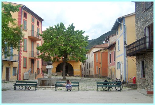
two. The highest point on this side is the town square in la
Tour.
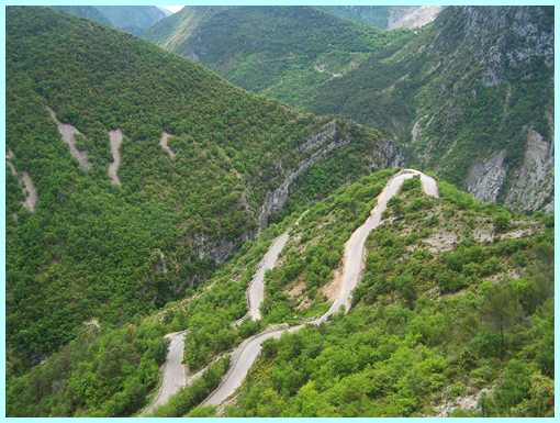
Approaches From East. A massive series of switchbacks climb out of the canyon of the Tinee. It is rare that the point of highest elevation on a bicycle ride is a medieval town square. Yet there are two spots, that fit this description on this ride: this one, and the other summit on D32 Utelle. This is very different than standing on a windy mountain top, exposed to the elements. Both town squares isolate you from the natural surroundings, and you can spend your time in a restaurant or local store. The town square imparts a feeling, that is comparable to the safety of a bird's nest, eliminating all impression of drops next to the road along the way.
From West. The road uses a few switchbacks while
descending to cross a canyon at half height. It takes quite a
bit of effort to regain the lost elevation on the adjoining D32
Utelle summit(u), especially on a fully loaded mountain
bike. A day on an Extended Tour:
D32 Utelle s(u) , D32
La Tour s(u) , D26
Tournefort s(u): Entrevaux > N202 east > D26
Tournefort s(u) > D32 La Tour s(u) > D32 Utelle s(u)
> D2565 north > Lantosque: 55.2miles with 5290ft of
climbing in 5:37 hours on a fully loaded mountain bike (VDO
MC1.0: m4:12.5.24).
back to Cycling
Passes in Europe
|