|
|||||||||||||||||
|
|
|||||||||||||||||
| |
|
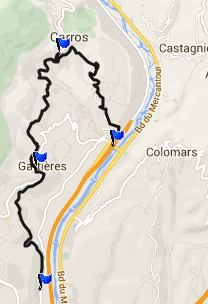
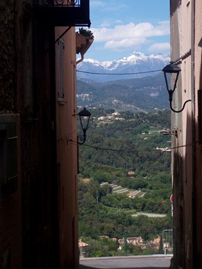
D1-D2209 Carros Village(sh)
 Cycling
along the Vars, from or to Nice, can be a frightening
experience with all that traffic, when riding this route for
the first time, and just following the most obvious route
that comes along. But actually, there is a much better
option on the other side of the river, the west side. A bike
path parallels the Vars almost into St Laurent du Var. While
on it, one has a much better chance to look around and spot
a few of the picturesque hilltowns above the valley. Cycling
along the Vars, from or to Nice, can be a frightening
experience with all that traffic, when riding this route for
the first time, and just following the most obvious route
that comes along. But actually, there is a much better
option on the other side of the river, the west side. A bike
path parallels the Vars almost into St Laurent du Var. While
on it, one has a much better chance to look around and spot
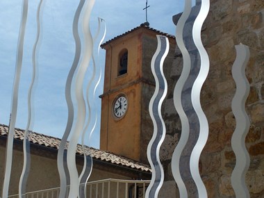
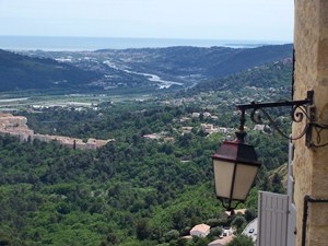
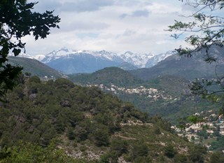
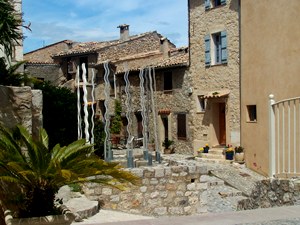
a few of the picturesque hilltowns above the valley.This short summit ride (which can obviously be extended into infinity) goes to two of the hilltowns on the west side of the the river. In Carros Village and Galitieres the medieval core is still there, and so is the picture perfect hilltown look. But it's all embedded in a matrix of modernity, complete with smoothly paved alleyways, that would have been from outer space a 1000 years ago. Sometimes there is even a piece of modern art in the old medieval town square
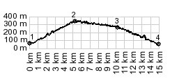
Approaches From South. (described downwards).
This side is not nearly as steep. It is a long curvy traverse.
And along the way the road collects another hilltown, Galtieres.
The proximity to Nice makes this place the opposite of sleepy
and isolated. The profile follows D1 all the way into the
valley. This is easily accomplised by following every St Laurent
du Var sign along the way. But the descend can be shortened by
one of the may Chemin Rural options directly into the valley, or
postphoned by heading for Vence instead. The first day with different start and end points on this tour is on page: Col de Palmarella/ Col de la Croix
|
|
|
advertisement |
|
|
advertisement |