| |
| |
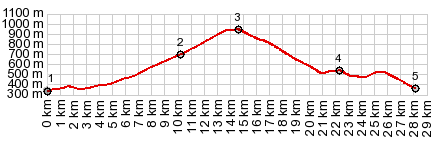
Sella Chiunzutan Looking at this road on the
map, you would suspect that it has very
light traffic. It is a connection that
parallels a much busier road in the valley
in the valley of the river Tagliamento,
south of the city Tolmezzo. But this road
goes through curvier terrain following
narrow canyons and crosses a plateau top.
And yes - traffic is light, in spite of
the fact that this is a pretty wide road.
My favorite part is the descent into
Tolmezzo, for which there are several
options.
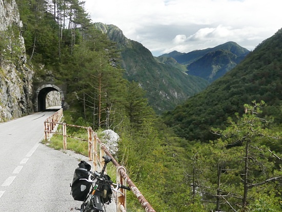
From
North. (described downwards). The
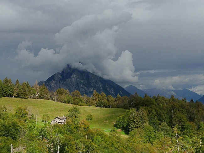
most interesting views on this Sella come a
little further down this side. They are of
the sharp peaks behind Tolmezzo. Especially
the highest one is a wizzard of cloud
construction, during turbulent athmosphere
days, like I was experiencing. If it's sunny
on the bike, there may well be a
thunderstorm over the mountains behind
Tolmezzo. At little later it was raining on
the bike, and the mountain produced
cumulus-nimbus high into the sky, surrounded
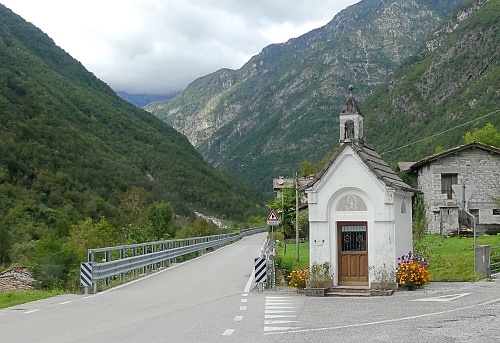
by sunshine on Tolmezzo. Rather than descending
directly into Tolmezzo the profile stays on
a balcony of sorts and takes in the views of
Villa and its church and then decends into
Vilino, crossing the river Tagliamento a
little further upstream. No pictures from
that part of the tour - it was raining
profusely.
|
|
|
advertisement |
|
|
advertisement |