| |
| |
Col Bagargui/ Iraty
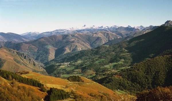
The peaks in this part of the
eastern Pyrenees reach "only" about 1800 meters in
height. But you could say that this landscape has
more depth than height, because of the many small
incised canyons, covered in lush vegetation.
Through these green hills runs a maze of tiny
steep, curvy roads with named passes. But for an
English speaker the names are a challenge to
remember the first time around. After Port de
Larrau, Col Bagargui is one of the better known
roads on this edge of Basque country.
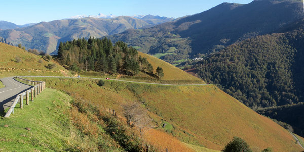
That was the last chance to relax a bit. A series
of steep switchbacks climb the green grassy
blanket on the other side of the valley. I pick
one of the switchbacks as scenic perch for lunch.
Once out of the valley the road seems to traverse
straight up the hill, heading for the apex of the
ridge, surrounded by open grasslands. Near the top a few more switchbacks curve around old stone buildings, half built into the ground, that seem to be used for animal herding. They make a great foreground in photos. The top is small collection of ski area structures, not the industrial quad chair variety, but a small collection of buildings that fit into the landscape. The highest point of the road comes shortly before the actual pass.
From South. (described
downwards) This side is just a shallow hill in the
forest with a few switchbacks. At the bottom of
the small depression lies the village of Iraty, or
at least the part that is known as "les Chalets de
Iraty". It is not on my map, but the directional
signs in the area reference it. Actually it is
just a business or two and a group of residences.
In my case did none showed any signs of being open
or occupied. Several routes meet here. All except
one go to other passes, and that one dead ends (or
turns to a trail) on the Spanish border. The
profile follows it to its dead end. This is a
narrow curvy rolling track, the size of a
bikepath. Sometimes it closely follows the noisy
mountains stream Urbeitza. Sometimes it climbs a
little above it. At the end a trail continues. The more common way to approach the aforementioned valley, containing part of Iraty, is from St Jean Le Vieux. It first goes over the low but steep Col Burdincurucheta, and then only descends about 110 meters to the intersection.
A Dayride with this point as intermediate
summit is on page: Port de Larrau History Cycling-Tour de France: This pass was
three times on the Tour de France Route. In
1986 and 1987 the race only climbed the miniscyle
southern approach from Iraty. In 2003 the tour
climbed the challenging north side.
|
|
|
advertisement |
|
|
advertisement |


