| |
| |
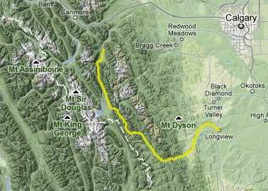
Highwood Pass
Chances are, after cycling this
road, you would never guess that you just
conquered the highest paved Rocky Mountain pass in
Canada. It barely reaches treeline ! But the
superlative of this landscape is not so much in
its pure dimensions, but in its steep precipes,
much like a canyon that is well on its way to
being eroded further, until it becomes a
collection of blocks, monuments and walls. The
road itself is as monumentally broad as the
Icefields Parkway, but only carries a fraction of
the summer traffic. A ride over Highwood Pass is
described a further in the touring stories
section, on this
page under the headings "Kananaskis Country"
and "Peter Lougheed Provincial Park". The pass is
near but east of the Continental Divide.
 Approaches ApproachesFrom East. The road has a rolling hill character that reaches to a few miles below the summit. But there is nothing rolling about the peaks next to the road. From the top a short hike dramatically improves one's vantage point onto surrounding mountains, as shown by the last two pictures. From West. The dominant scenic feature on
this side of the pass may well be at its bottom
and a dozen miles further off the main road.
Kananaskis Lakes Provincial Park has moutain lakes
of a size that is rarely found on this side of the
Continental Divide in Canada. The size of the
lakes is superseded only by the precipitessness of
the mountains surrounding them. The gradual climb
through forest up to the pass gives plenty of
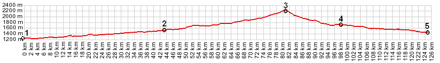
opportunity to remember this image. 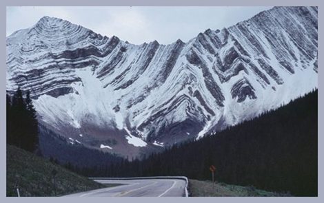 Tours Dayrides. A dayride, exploring several options on the biketrail along Kananaskis Lake and extending to the top of the pass and back, measured 58 miles and 4800 feet of climbing (which was too high due to a week battery), using an Cateye 100A cycle computer. Another dayride, combining dirt roads with luxuriously paved Highwood Pass started on the Forestry Trunk Road near the Kananaskis Country boundary and climbed the pass from the other side, then returned to the starting point by the same route. It measured 71 miles with 5070 feet of climbing, using the same setup. 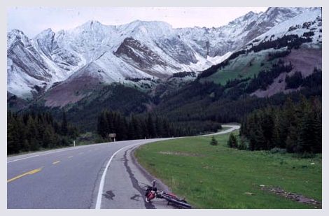
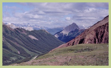 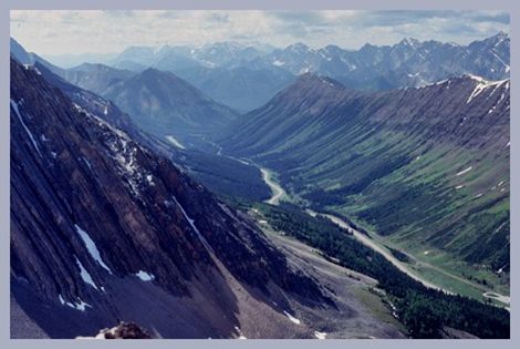 Picture Locations: The
last two pictures were taken on foot, a small
distance above the pass; the first two on the
southern approach
|
|
|
advertisement |
|
|
advertisement |