| |
| |
Bow Pass The Icefields Parkway can be
neatly divided into two passes and their
approaches. Bow Pass is the southern summit of
these two, traversing the highest road altitude
between Lake Louise and Saskatchewan River
Crossing. It is also the highest point on the
Icefields Parkway. A ride over the pass is
described in more detail on this page, under
the heading "la promenade des glaciers - the
Icefields Parkway".
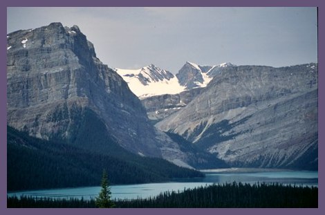
Approaches From South. This road is a wide highway
with a shoulder the size of almost another road.
The shoulder is however sacrificed for a climbing
lane for cars on the way to Bow Lake.
From North. Again it is surprising, just
how few turns this highway has to make to reach a
pass surrounded by glaciers. Tours Extended Tour. The Icefields
Parkway is where vacationing bicycle tourists
converge in the summer. While the rest of the
continent may be ruled by stinking, polluting
ATVs, and noisy 4wd trucks, Bow Pass is filled
with cycle tourists from around the world, touring
in pairs, groups or solo. There is a youth hostel
network along the road. However, campground do not
make special provisions for cyclists. The 800hp
camping rigs with motorized lifts and awnings,
satellite dishes and noisy propane electricity
generators still rule this continent. 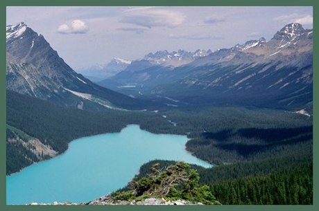 History
Exploration by military and official expeditions: The Palliser Expedition. (<Kicking Horse Pass|) The period prior to the civil war was a time when many of the northern Montana passes became officially mapped. This also prompted a push for more exploration to the north in the Canadian Rockies. Far less populated and still under British control, many of the commonly used passes during fur trading days were all but forgotten. Meanwhile Canada and the American states had settled on the 49th parallel as their boundary. For the majority of Columbia River bound Canadian travelers, this made it necessary to cross into the US in order to get across the Rocky Mountains. This situation had to be remedied, especially if there was ever going to be a Canadian transcontinental railroad. The result was the Palliser Expedition. Its independent group of British, Scottish-French halfbreeds and one American managed to split into three groups and rediscover many "new" passes. But their most important discovery was really caused by an accident, when a a horse plunging into a river caused injury, the loss of food, and a desperate search for a quick way back. This resulted in the discovery of aptly named "Kicking Horse" Pass. Nobody knew it at the time, but Kicking Horse Pass would later become the answer to the real lasting impact of the Palliser Survey: the route for a Canadian transcontinental railroad. A recorded crossing over Bow Pass was an anticlimactic afterthought during that same fall in 1858. One of the three group leaders of the Palliser expedition, John Hector had an Indian guide. His name is recorded as "Nimrod", because Hector could not pronounce it. According to Marshall Spraque's "The Great Gates", Nimrod guided a number of members of the Palliser Expedition under James Hector over Bow Pass down the Mistaya River to the North Saskatchewan and winter quarters at Fort Edmunton. The next June Hector would go Frazier River hunting again. His Indian guide eventually vanished into thin air, and Hector redsicovered another "new" passes from the fur trader days that is still a trail today, Howse Pass.
Modern Highways (<Sunwapta Pass|)
The Icefields Parkway was a late result of
the road building frenzy that followed
WW1 in both the US and Canada. The first
Canadian Rockies Pass to be crossed by a
highway was Vermillion Pass in 1923. Kicking
Horse, Crowsnest, Yellowhead and Sinclair
followed. Finally Canada's first
commissioner of Public Parks planned a route
north along the main range from Banff.
Sunwapta Pass was crossed first and the
early version of the highway was completed
in 1940. |

|
|
advertisement |
|
|
advertisement |