| |
| |
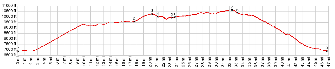
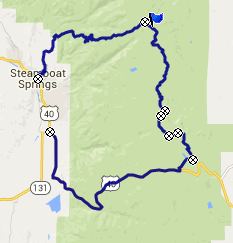
Wyoming Trail s(u) The Wyoming Trail is part of
the Continental Divide Trail in extreme
northern Colorado. Together with a section of
dirt road it connects the tops of Old
Rabbit Ears Pass and Buffalo Pass, in
the Gore Range west of Steamboat Springs. The
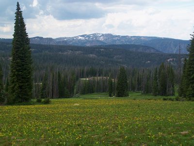
most interesting sections for me were near the
two endpoints of the Wyoming Trail, where the
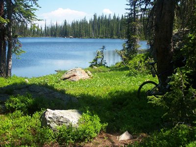
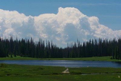
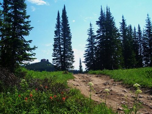
forest opens up far views. The trail itself is
an endless traverse between small lakes, mud
puddles, grown over swampy areas, and hybrids
of all three, next to - or on the trail. There
must be 40 or 50 of them, but counting is hard
because one man's lake is another's mud
puddle.
The route to "Old Rabbit Ears Pass" is marked
with the sign "Dumont Lake". At the old historic
pass marker an unpaved road heads north, through
a forest of "no camping" signs, and splits into
three options immediately after the initial
junction. FR311 is the middle of these roads. It
climbs into open meadows at a slope that is
perfect for a good workout, and actually - in my
opinion - these first couple of miles are the
most scenic and interesting of the entire loop -
by far - and we aren't even on the Wyoming Trail
yet. Instead FR311 reaches a shoulder summit in
its own right. The map shows it descending back
to the Rabbit Ears Pass Road. At the top of FR311 two signs mark the
junctions with the Wyoming Trail. First it joins
from below, and then the Wyoming Trail heads
north at a well marked trailhead, near the end
of FR311. The trail actually descends from the
trailhead and contains many muddy sections. The
descent is a little over 500ft. So I count it as
a separate summit. The section between FR311 and
Lost Lake contained so much downed timber and
muddy spots that progress was very slow.
At Lost Lake a sign might be helpful that the
main trail continues to the left, leading to the
next of this endless string of nondescript small
lakes in the woods. This would have made my ride
55 minutes shorter. But now I know what if feels
like to carry my bike to the other end of Lost
Lake and back, looking for a trail in the woods. The endless traverse between muddy lakes
continues to a grand intersection in the forest.
All four directions are well signed, and the
Wyoming Trail continues straight. From here
progress becomes much faster. The trail seems to
be maintained for tourists, be they cyclists or
ATV drivers, and from here to Buffalo Pass I
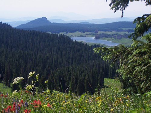
meet several of each species. There are no far views on any part of this
trail till the descend to Buffalo Pass begins.
Finally a hazy image of North Park and a faint
Rawah Ridge appears between gnarly branches,
eaten by beetles. From North. (described
downwards). Approaching the highest part on this
trail, the forest opens for the first time since
leaving FR311. The double track trail crosses
under a power line and over one single last
remnant of spring snow. To the the north the
Mount Zirkel Wilderness appears behind a blanket
of wild flowers. A quick descend leads to a
whole complex of parking lots at the top of
Buffalo Pass. The profile descends Buffalo Pass to Steamboat
Springs. The exceedingly rough road does not
stop a whole battalion of tent campers from
driving up here. But my visit is on the 4th of
July weekend, and I think that weekend has
mandatory camping for many people. At other
times it is less hectic. A short section of Buffalo Pass runs through open meadows, giving far views into the Yampa Valley. The road crosses two gates and with each crossed gate the road takes a distinct step to a more civilized character. That also means that suddenly, camping in the forest is no longer allowed, except for one last fee campground. When the road exits the National Forest it becomes a hard medalled surface, approaching Steamboat Springs finally a paved road between fields.
Dayride with the point as hugest summit: PARTIALLY PAVED / UNPAVED / TRAIL (< Old
Rabbit Ears Pass| FR103
Chimney Rock Rd s(u) >)
|
|
|
advertisement |
|
|
advertisement |