| |
| |
Turner Gulch Rd s(u)
This is a gradually climbing road in
South Park between Tarryall Rerservour and busy
US24. The road is completely devoid of washboard
surface, as unusual as that might sound. It makes
part of a scenic loop in conjunction with paved
Tarryall Rd.
From South. (described
downwards). The upper part of the descend in in
forested country. When the infinite green spread,
that is South Park opens up again, the road enters
a kind of parcel real estate development area,
where most owners apparently use their property to
park large RVs. The profile takes the most obvious
route to US24, and joins it just below the slope
to Wilkerson Pass
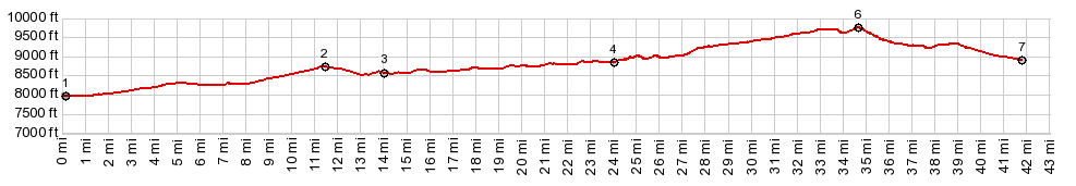
starts. 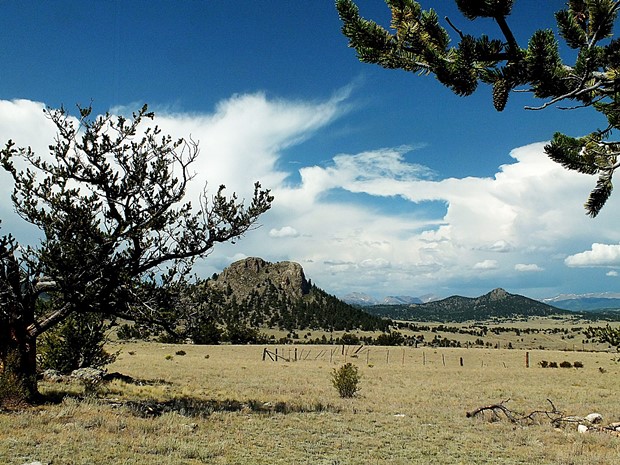 Dayride with this point as highest summit: PARTIALLY PAVED / UNPAVED ( | FR308 Mushroom Gulch s(u) > ) Turner Gulch Rd s(u) , Wilkerson Pass : CR77 Tarryall Rd, several miles from jct with US24 > CR77 north > Tarryall Reservoir with short detour > Turner Gulch Rd south > Turner Gulch s(u) > shortest, most easterly way to US24 > US24 east > Wilkerson Pass > CR77 Tarryall Rd north back to starting point: 58.0miles with 3800ft of climbing in 5:15hrs (garmin etrex30 m3:19.9.6) Notes: in order to avoid traffic in favor of unpaved roads as much as possible, it would be better to substitute La Salle Pass for Wilkerson Pass. The nicest part of this ride was arguably CR77 between US24 and Tarryall Reservoir, immaculate pavement, beautiful scenery and no traffic. 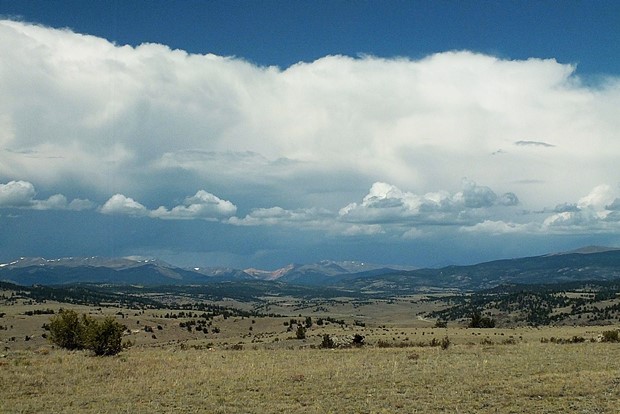 |
|
|
advertisement |
|
|
advertisement |