| |
|
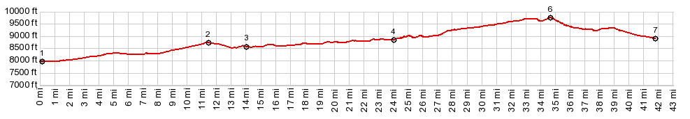
1.(00.0mile,7980ft) START-END EAST:jct
US24 - Tarryall Road
2.(11.4mile,8810ft)intermediate high point on paved
Tarryall Road
3.(14.0mile,8580ft)Bayou Salado Reservoir
4.(24.0mile,8850ft)profile turns onto Turner Gulch Rd
5.(34.7mile,9770ft)TOP
6.(41.9mile,8910ft) START-END WEST: jct US24 - San Juan
St
|