| |
| |
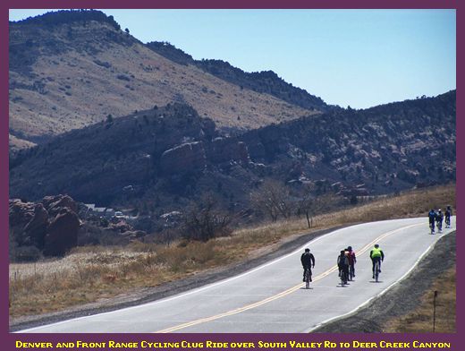
South Valley Road
(sh)
Even never leaving suburban
Denver, there are a number of small,
interesting climbs in the hogback ridges of
the western suburbs. This is one of the most
popular. There are number of different summit
points in between these upscale suburban
developments. But they all share the amazing
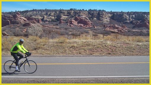
rock monument scenery of South Valley Park, on
the south side of this approach.
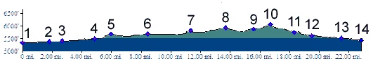
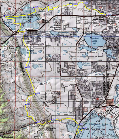
From North. Between points
1 and 8, the profiled route is the same as the
one to C470
bike path - Bowles Ave(sh). At point 8 the
profiled route turns right onto Ken Karyl Blvd.
At the first jct, going right onto North Valley Blvd
is also an option, leading a few feet higher,
which then merges back into the profile at the
summit. Following South Valley Rd, a short
climb on a four lane road leads to the top.
There is also a bike path on the east side of
the road, but it doesn't seem to get much use From South. (described
downwards). Shortly after the summit, there is
an access area to South Valley Park on the east
side of the road. I often pass this way roughly
around lunch time and the elaborate picknick
shelters make a great lunch spot. On a nice day
it's amazing how many cyclists you see climbing
up form Turkey Creek Canyon. The rest of the short descent is some the nicest scenery that suburban Denver has to show off. These are the nature sculptured rock outcrops behind the first hogback. The profile continues down Deer Creek Canyon. Taking a left at point 12 onto Ute Drive, makes it possible to get back onto the C470 path after a tiny climb. The profile goes to the start of Deer Creek Canyon road, where many bikers park their cars, and a little further to the shores of Chatfield Reservoir. . |
|
|
advertisement |
|
|
advertisement |