| |
| |
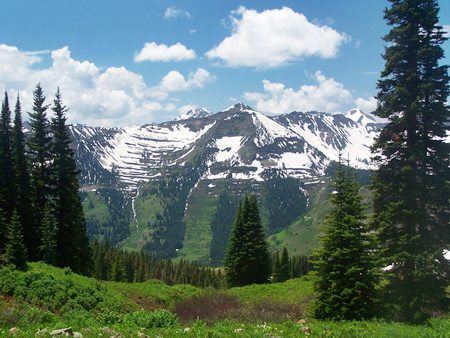
FR811 Washington Gulch(sh)
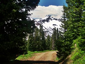
When I approached Crested Butte
from Gunnison on Co135 in July of 2011, a solid
wall of snow was still behind Crested Butte. The
view was of the northern faces of peaks in the
Ruby Range. The winter of 2010/11 brought a lot of
snow to this area, but for July this still was
unexpected. But when high passes like the Paradise
Divide and famous trails like TR403 are still
snowed in, this dirt road summit point, located on
a shoulder of the Paradise Divide, still offers
more scenery than many states have in their
entirety.
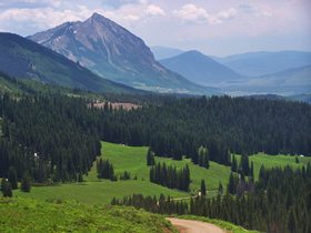
From North. leaving Crested Butte towards
the north, a fork in the road forces you to make a
decision. Shall I go to the ski resort, or up
Washington Gulch ? For me this is usually easy:
Washington Gulch it is. The road remains paved
with very little traffic, two ingredients for a
good road ride, till it reaches a sort of "Ober
Crested Butte", located in the area of Meridian
Lake. Now the road becomes more rustic and dips
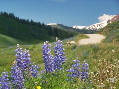
through patches of forest, rolls ever higher to
alpine meadows. Looking back, Mount Crested Butte
is a small mountain in the company of all these
white giants. But it has an unmistakable
characteristic shape. With some imagination it is
a sharp, pointed tooth of an imaginary
world-eating shark in the gums of the Ruby Range.
It is interesting to think that downhill skiers
are limited to this in-comparison small mountain.
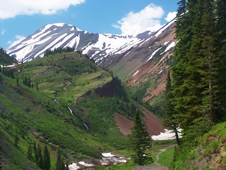
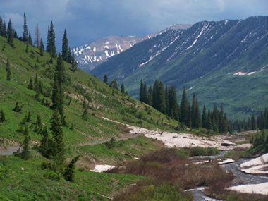
From South. (described
downwards) There is more snow on this side, or at
least more water that used to be snow. The road
traverses along half height of the ridge,
periodically offering fine views, framed by
patches of pine forest. It is less than 300ft of
descend before the road merges onto FR734 to the
Paradise Divide, and therefore I'll call this a
shoulder summit on the Paradise Divide.
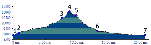
Dayride. PARTIALLY PAVED / UNPAVED / SINGLE TRACK
History Cycling. An early mountain biking guide, first published in 1987, describes a traversal of the loop, pictured in the profile in the reverse direction, calling it "Slate River/ Washington Gulch Loop". The author rates this ride as "ride rating: moderate/ strenuous, skill level: intermediate, and approximate ride time: 4 hours".(William L. Stoehr's: Bicycling the Backcountry). Mountain bikes had no suspension at that time. |
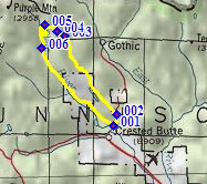 Approaches
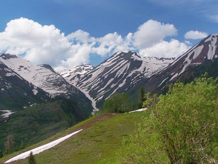
|
|
advertisement |
|
|
advertisement |