| |
| |
Divide Road summit(u) When travelling on US50 from
Delta to Montrose, you see a long, low landform
to the west. It doesn't look like much from this
vantage point. It seems the horizon is just a
little bit higher. During a summer afternoon it
may fuse with dark purple clouds above it and
become totally invisible. You would never
suspect that a bike ride over this landform
involves more than 4000ft of climbing. What you
are really looking at, is the dip slope of the
Uncompahgre Plateau. The sedimentary rock layers
are tilted, but only at a relatively small
angle, and the dip slope is the shallow rise
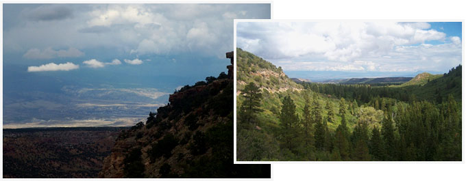
onto this plateau. On the opposite side, this
plateau breaks off in spectacular cliffs, that
are perpendicular to the rock layers (the strike
slope). There are innumerable more complicated
ways to climb to the road that leads very
roughly along the crest of this plateau, than
the one described here. All of these alternate
options also offer plenty of ways to get lost,
even though the major intersections are all well
signed. The profile shown here climbs the
plateau on its major roads from the east side,
where also the major centers of population are,
from Montrose and Delta.
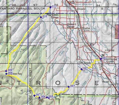
From South. One nice thing about this approach is that it is easy to find. Just continue west from the already east-west running Main Street in Montrose. However the intersection is poorly signed. You don't see the Co90 sign until after you are on it for several blocks. After that Co90 sign direct you along a route filled with perpendicular turns to the outskirts of Montrose. Co90 become CR90 and turns unpaved, when it starts to climb the first steps from the still low canyons of the Uncompahre Plateau, up to its erosional surface. Once on top of this slanted plain, the ride continues along a straight road through a juniper forest, albeit an inclined forest. Past its junction with Rim Road,
CR90 takes a steep dip to cross the East Fork of
Dry Creek, which can be really wet and snowy at
the crossing, depending on conditions. Back up on
the surface the road continues to climb and enters
a densely forested high plain. Here the road
crosses into the National Forest and joins the
Divide Road. Even though never far from the edge
of the plateau on the west side, you never really
see it from the road. The road reaches a high
point at the turnoff to a radio facility on the
west side.
From North. (described
downward) After the summit the road does not
really descend very much, it just rolls along
through the forest for many miles. Then suddenly
Divide Road does after all approach the strike
slope on the west side and the dramatic break in
the landscape becomes apparent. Soon after the
route crosses Columbine Pass. The spot is not
signed, but signs on both approaches refer to the
location. The profiled route leaves Divide Road
and continues down Mesa Road on its long steady
descend towards Delta. Only in one single spot,
does the road break its straight ahead habit and
curves down through the juniper forest, in order
to find a new course alongside the canyon. The
most scenic part of the journey, in my opinion, is
still ahead. This happens when the road runs along
the ridge between Monitor Creek and Cottonwood
Creek and delivers a dessert panorama with Grand
Mesa in the background. The road reaches a low
point when it crosses Robideau Creek, shortly past
a dirt road by the same name.
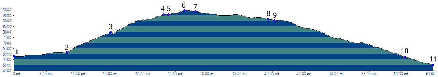
Dayrides. PARTIALLY PAVED / UNPAVED
Divide Road s(u): lower
part of CR90 west of Montrose > up CR90 >
CR402 Divide Rd s(u) > Columbine Pass(shp) >
down Mesa Rd > Co348 south > Olathe >
US50 south > Montrose > CR90 back to
starting point: 97.0miles with 6120ft of climbing
in 7:40hours (VDO MC1.0 m3:11.9.15).
---------------no measured
altitude---------------
same summit: 25rd/Mesa rd (south west of Delta) > up Mesa Rd > CR402 south > Columbine Pass(shp) > down CR90 > Montrose area > unspecified route in valley north > back to starting point: 96miles (mech Odo m1:93.6.4)
|
 Approaches
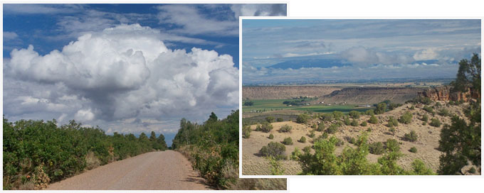

|
|
advertisement |
|
|
advertisement |