| |
|
-
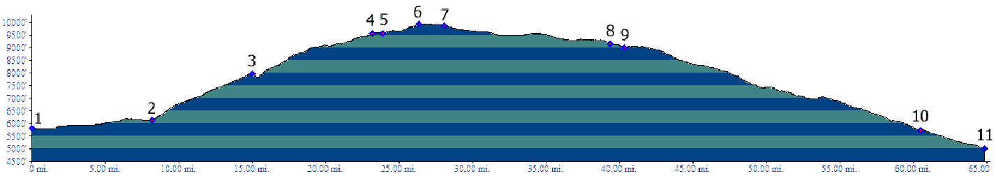
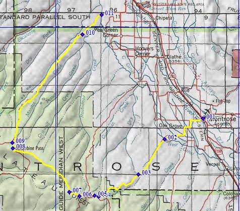
1.(5800ft,mile00) START-END SOUTH: Montrose, jct US50 - Main Street: Co90 leaves towards west
2.(6140ft,mile09) Co90 becomes CR90 at the outskirts of Montrose
3.(7970ft,mile16) junction with Rim Road on left
4.(9550ft,mile23) South Divide Road joins from left. Profile stays straight, now called the North Divide Road.
5.(9560ft,mile24) CR90 turns off to left
6.(9940ft,mile27) TOP, at turnoff to radio towers on left
7.(9870ft,mile29) Houser Road turns off to left
8.(~9140ft,mile20) Columbine Pass and jct with Mesa Road. Profile turns right onto Mesa Road
9.(9000ft,mile21) Profile continues straight on Mesa Road, while North Divide Road turns off on left
10.(5730ft,mile61) the Narrows
11.(5000ft,mile65) START-END NORTH: 25 Mesa Road crosses Robideau Creek, south west of Delta
-