| |
| |
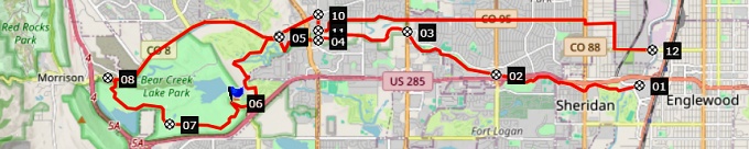
Bear Creek Trail: Dam
Overlook(sh)
aka Mount Carbon(sh) There is no lower place with
better panoramic views in the area west of
Denver, and just a couple that are higher -
arguably.... and the top is only accessible
with a bike trail, albeit the road is never
more than a quarter mile away. The map also
marks this location on a small hill above Bear
Creek Dam with the name Mount Carbon. But
don't expect a real mountain, but something
just big enough for a great view covering 360
degrees.
 Approaches
From South.
Constructing a strictly decreasing descent
with a clear route on this side is less obvious.
A few "mini golf" versions of switchbacks lead
down towards the reservoir in a matter of
seconds. Actually taking the first option to get
off the Bear Creek Trail and head east again on
residential streets is probably the option
decreasing most quickly in elevation. But I
think the attraction of this locations is really
the unbroken bike path option, Clear Creek Trail
changing to C470 Trail heading north and then
taking Morrison Road to head east and loose
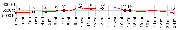
elevation slowly. This is what the profile does. 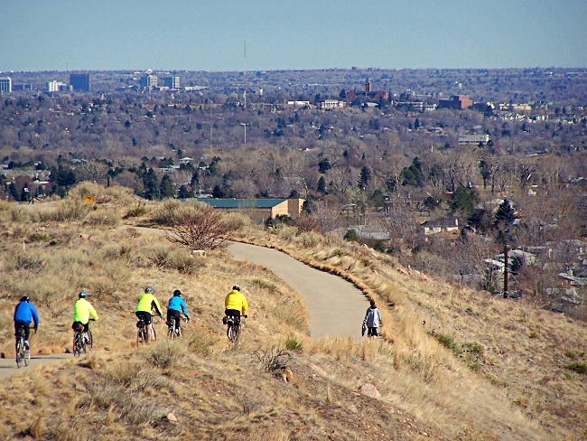 The profile follows reasonably
bike friendly suburban streets east back to the
Platte River Trail. Along the way are several
designated bike routes to head north, that will
keep Monte Cabonara as the highest point on the
route: along Garrison Ave, and along Pierce St,
just to mention a few.
 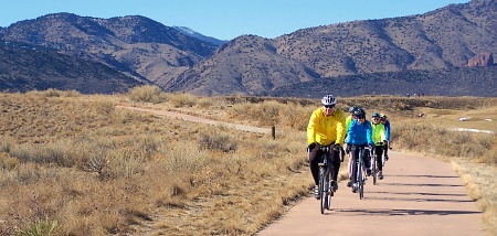 |
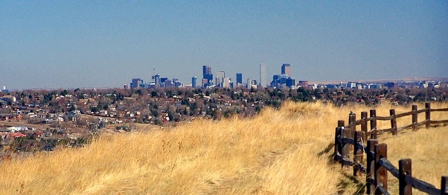
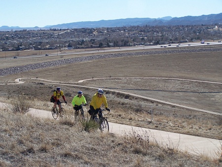 Actual real climbing begins
after the trail enters Bear Creek Park and
passes a golf course. This route heads for the
south side of the Dam. The narrow paved path
winds up grassy slopes between golf carts, faded
grass blowing in the wind, and steadily
improving far views. The foothills are nice. But
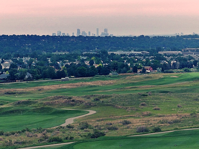
the real characteristic view from this stretch
is the Denver skyline: distant high rise offic
buildings, truncated by orderly rows of suburban
housing. The "summit house" soon appears in
close view. It turns out to be an out house.
This is the most scenically placed toilet in all
of the Denver Metro area, as far as I know, the
eye reaching from lake over foothills to skyline
and rolling mesas in the far south. The "summit
house" is a hundred yards or so past the turnoff
to the downhill on the west side. The option of
going around the the south side of the dam
actually traverses a lower point, with not
enough elevation gain (500ft) in order to
qualify as summit point for these pages.
Actual real climbing begins
after the trail enters Bear Creek Park and
passes a golf course. This route heads for the
south side of the Dam. The narrow paved path
winds up grassy slopes between golf carts, faded
grass blowing in the wind, and steadily
improving far views. The foothills are nice. But
the real characteristic view from this stretch
is the Denver skyline: distant high rise offic
buildings, truncated by orderly rows of suburban
housing. The "summit house" soon appears in
close view. It turns out to be an out house.
This is the most scenically placed toilet in all
of the Denver Metro area, as far as I know, the
eye reaching from lake over foothills to skyline
and rolling mesas in the far south. The "summit
house" is a hundred yards or so past the turnoff
to the downhill on the west side. The option of
going around the the south side of the dam
actually traverses a lower point, with not
enough elevation gain (500ft) in order to
qualify as summit point for these pages.|
|
advertisement |
|
|
advertisement |