| |
This is a short loop on a good
gravel road from Creede. It is popular with
motor people, but the traffic was not bad when I
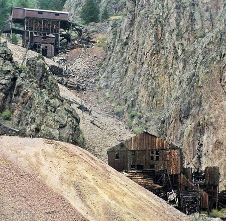
was there. The outstanding characteristic of
this loop are the mining ruins along the way,
expecially a Superfund cleanup site at the
eastern start of the profile
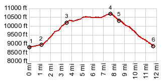
The initial 2 mile climb is incredibly steep, and
the mining ruins stuck on the canyon walls in both
directions look like leftover civilization after
an apocalyptic event. They have that charred
appearance. After the torture of the first 2 miles
the road levels out and intermediately rolls
through forested hills. The road switches back
onto itself several times, so that it is easy to
loose direction. The surface changes often, mostly
it is almost hard medalled without washboard. But
sometimes there are short stretches of deep
gravel. At one point "Bachelor Loop" signs make
sure that you take a critical counter-intuitive
left. The top is the site of the old mining town
Bachelor. Today all that remains is a parking lot
with an informational sign, also containing a few
faded pictures. The alpine meadow, once containing
the town, sits on a natural saddle and a nice view
of the upper Rio Grande Valley opens up here.
Dayride with this point as highest summit: PARTIALLY PAVED / UNPAVED ( < Ute Pass(Saguache | Elwood Pass > ) Bachelor Loop s(u) , additional out and back : about 2 mile up FR601 Pooltable Rd > down FR601 <> out and back on Co149 to Wagonwheel Gap >> Co148 west > Creede > up West Willow Creek Rd > Bachelor Rd s(u) > down Bachelor Rd with short detours > Creede > closed on Amthyst Dr > Ridge Dr > back to Creede >> Co148 east > back to startingpoint on FR601 Pooltable Rd: 41.9miles with 3360ft of climbing in 4:21hrs (garmin etrex30 m3:19.9.15) 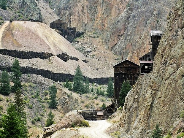 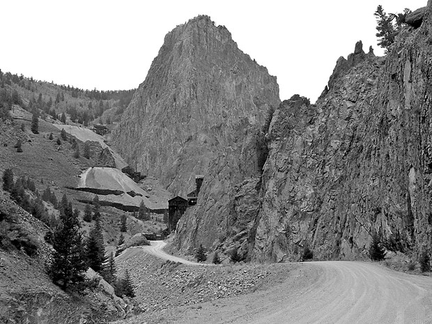 |