| |
|
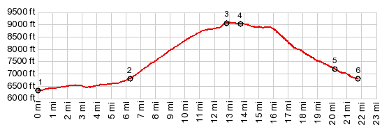
1.START-END NORTH-1:jct US278 - Green Mtn Rd
2.route splits into eastern and western part of loop road
3.TOP, 9060ft
4.jct with Mine Acess Rd and road to Wild Horse Point
5.jct with unmarked road, following East Cottonwood Creek
6.START-END NORTH-2:same as point 2
|